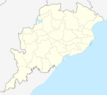
Koksara
| Koksara କୋକସରା | |
|---|---|
| town | |
 Koksara Location in Odisha, India | |
| Coordinates: 19°44′57″N 82°58′6″E / 19.74917°N 82.96833°ECoordinates: 19°44′57″N 82°58′6″E / 19.74917°N 82.96833°E | |
| Country |
|
| State | Odisha |
| District | Kalahandi |
| Population (2001) | |
| • Total | 4,255 |
| Languages | |
| • Official | Oriya |
| Time zone | IST (UTC+5:30) |
| PIN | 766019 |
| Sex ratio | 50.1:49.9 ♂/♀ |
| This town comes in the way of Notional Highway 201 | |
Koksara is one of the Town in Dharamgarh sub-division [1] in Kalahandi District in Odisha State. This town and Gram Panchayat comes under Kokasara Tehsil in Kalahandi District. Kokasara is 49.2 km distance from its District Main City Bhawanipatna. And 333 km distance from its State Main City Bhubaneswar.
Demographics
According to census 2001, Total Population of Koksara was 4,255, where it constitutes 2,131 of male and 2,124 of female population. Koksara had a total literacy population of 2,266, from which male literacy population was 1,435(63%) and female literacy population was 8,31(37%).The town had total sc population of 871 and total st population of 514.Whereas workers population was 1736, Cultivators population was 404 and non workers population was 2519 of the town according to census. The town had a balanced sex ratio as it led female per 1000 male was 997.The percentage of worker to population was 42%.
Education
- Schools nearby Koksara
- Chiladangari primary school
- Saraswati Sishu Mandir, Ladugaon
- Colleges nearby Koksara
- Priyadarshini Indira Mahavidyalaya, Junagarh
- Chandrika Jain Degree College, Borda
- Ladugaon Higher Secondary School, Ladugaon
- Panchayat Samiti Degree College, Koksara
- Panchayat samiti junior +2 college, koksara
- L.A. +2 Junior College, Behera
Nearby Tourist Places
- Jeypore 101 km near
- Jagdalpur 109 km near
- Kanker 159 km near
- Araku Valley 167 km near
Hospitals nearby
- Sub-Divisional Headquarters Hospital, Dharamgarh
- Sardar Raja Medical College, Jaring
- District Headquarters Hospital, Bhawanipatna
- Life Worth Hospital, Bhawanipatna
How to reach Koksara
AirPorts Nearby Koksara Raipur Airport 220 km near.
Railway Stations (Connecting Koksara)
- LELIGUMMA
Odisha, Rayagada, Kalyansingpur 73 km near
- TIKIRI
Odisha, Rayagada, Kasipur 75 km near
- KESINGA
Odisha, Kalahandi, Kesinga 87 km near
- RUPRA ROAD
Odisha, Kalahandi, Narala 88 km near
- RAIPUR JN
Chhattisgarh, Raipur, Raipur 235 km near
- Notes-Major Nearby Railway Station that connects to Maximum Number of Main stations in India.
References
External links
| ||||||||||||||||||