Koh Rong Sanloem
| Native name: <span class="nickname" ">កោះរុងសន្លឹម | |
|---|---|
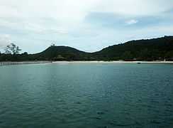
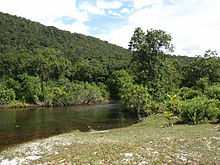 Koh Rong Sanloem estuary | |
 Koh Rong Sanloem in Cambodia | |
| Geography | |
| Location | Cambodia - South East Asia |
| Coordinates | 10°35′10″N 103°17′45″E / 10.58611°N 103.29583°ECoordinates: 10°35′10″N 103°17′45″E / 10.58611°N 103.29583°E |
| Area | 24.5 km2 (9.5 sq mi) |
| Length | 9.5 km (5.9 mi) |
| Width | 1–4.8 km (0.62–2.98 mi) |
| Coastline | 37 km (23 mi) |
| Highest point | 202m |
| Country | |
|
Cambodia | |
| Province | Sihanoukville |
| District | Mittakpheap |
| Commune | Sangkat 5 |
| Demographics | |
| Population | around 300, quickly growing |
| Ethnic groups | Khmer |
Koh Rong Sanloem (Khmer: កោះរុងសន្លឹម, also Kaoh Rong Sanloem) is an island off the coast of Sihanoukville, Cambodia, 4 kilometers south of Koh Rong island. It is around 9 kilometers long (north to south), 4 kilometers wide (east to west) and 1 kilometer wide at its narrowest point. Its distance from the local port of Sihanoukville is 25 kilometers (beeline) and 23 kilometers (beeline) from the Serendipity/Ochheuteal beach pier.[1] The word "Sanloem" translates to: 1. drowsiness[2] and to: 2. far out and hard to discern, in a wider sense.[3] Inconsistencies on how to spell the island's name in its Latinized version date back to the 19th century. The first controversial spelling variants were issued by map makers during French rule. Alternatives have since become widespread and are in common usage. Often confusion ensues as Google Maps offers the phonetically most consistent variant,[4] whereas Google Search redirects to an alternative.[5]
Koh Rong Sanloem lies within Sihanoukville province's Mittakpheap district in Commune 5 (Sangkat Koh Rong). Alongside its sister-island Koh Rong it has developed into a popular holiday destination for individual travelers. With respect to the island's very tiny population, the tourism sector is by 2014 the core economy.[6][7]
Geography
The island resembles its northern sister, Koh Rong in many ways, although it has noticeably less landmass in relation to its coastline. The terrain is predominantly hilly with a few mountains of moderate size (e.g. La Chameau - The camel). The interior is almost entirely covered in dense jungle. The coastline is characterized by a succession of sandstone rock formations and beautiful beaches. There are three yellow sand beaches at the island's long western coast. Its eastern side, facing towards the mainland and less exposed to the weather and the monsoon, is characterized by bays and headlands. A very attractive feature is the crescent shaped Saracen Beach bay with an inner diameter of around 3 kilometers. Saracen bay got its name from a British survey brig, HMS Saracen, that charted the area in the late nineteenth century.[8] North of the island lies the uninhabited Koh Koun island, followed by Koh Rong.
Settlements and Infrastructure
There are two discernible villages on the island; one in the north, called Ma-pay Bay[9] (means 23 in Khmer) and one in the south, called Koh Rong Sanloem Phumi Kang Khnong (kang khnong means inside in Khmer), which is little more than a fisher's hamlet. Another little hamlet is situated in the southwest, called Phumi Kang Krau (Village on the outside).[10] There used to be a basic road network, built during the period of the French Protectorate, which is by now almost completely overgrown with vegetation. Sole reminder of this period is a lighthouse at the island's southern tip. Depending on the season, some structures that resemble a landing field near the light house are still recognizable.
Most transport is being done by boat, although the island's very narrow center permits water buffalo carts to operate. Koh Rong Sanloem is not connected to the main power grid, nor to the internet, although there is local mobile phone coverage. The island is home to a base of and is administered by the Cambodian Navy.
Tourism

More than a dozen guest houses and bungalow resorts have been established by 2014. Although most of these businesses are scattered all over the whole island, Saracen beach has become the primary place of arrival and departure with the highest number and density of resorts followed by Ma-pay Bay located at the northern end of the island. Accommodation and prices range from cheap dorm beds to well furnished solid bungalows.[11] There are a few daily scheduled ferries (around 2-2.5 hours) and 2 speed ferries (25 min and 45 min) to the island. Departure is at the local port of Sihanoukville and the piers at Serendipity beach and Victory beach.[12][13]
Wildlife
The island's formidable jungle is the ideal habitat for a great variety of endemic Invertebrate species. Vertebrates are less abundant and, typically for island populations, are small in comparison. Amphibians and reptiles are the most numerous and the island's brooks, ponds and streams are home to a variety of small freshwater fish. Birds include the Great Horn-bill, the King Fisher and the Osprey. There is a group of Macaques living on the island and rodents are very common as a consequence of human activities. Small reefs and the rocky surface of the surrounding waters are home to a remarkable variety of marine species. Divers and Snorkelers regularly emphasize the presence of delicate miniature Eco-systems, seahorses and nudibranches are particularly diverse.[14]
Gallery
-
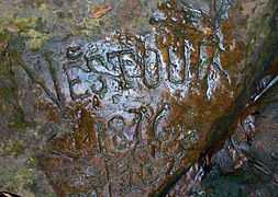
"Nestour 1876"
-
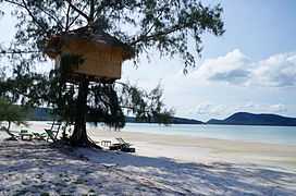
beach tree house at Saracen bay
-
Koh Rong Sanloem during rainy season 2014
-
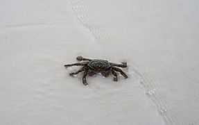
crab on Saracen Bay Beach
-
Mont Chameau (camel)
-
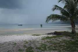
Saracen Bay Beach lagoon
See also
- Sihanoukville
- Koh Rong
- Koh Sdach
- Koh Pring
- List of islands of Cambodia
- List of Cambodian inland islands
References
- ↑ https://maps.google.com.kh/maps?q=Koh+Rong,+Mittakpheap,+Sihanoukville&hl=en&ll=10.667356,103.365211&spn=0.168695,0.338173&sll=10.60876,104.183977&sspn=0.021091,0.042272&oq=koh&t=h&z=12
- ↑ https://translate.google.com/#km/en/%E1%9E%9F%E1%9E%93%E1%9F%92%E1%9E%9B%E1%9E%B9%E1%9E%98
- ↑ http://www.icran.org/pdf/Assessing%20Legislation%20and%20Management%20Koh%20Rong.pdf
- ↑ https://www.google.com.kh/maps/place/Koh+Rong+Sanloem/@10.5837111,103.3090782,13z/data=!3m1!4b1!4m2!3m1!1s0x3107eede3706b249:0xf4bc7be5df0f6e74
- ↑ https://www.google.com.kh/search?q=koh+rong+sanloem&oq=koh&aqs=chrome.2.69i60l2j69i59j69i57j69i59l2.3641j0j7&sourceid=chrome&es_sm=93&ie=UTF-8
- ↑ http://www.thepartyboat.asia/
- ↑ http://www.canbypublications.com/cambodia-islands/cambodia-islands-home.htm
- ↑ https://archive.org/stream/directoryfornavi00find/directoryfornavi00find_djvu.txt
- ↑ http://www.travelfish.org/location/cambodia/southern_cambodia/sihanoukville/koh_rong_samloem
- ↑ http://www.geonames.org/maps/google_10.588_103.298.html
- ↑ http://www.koh-rong-samloem-island/beach-bungalows.html
- ↑ http://www.koh-rong-samloem-island.com/boat-timetables.html
- ↑ http://www.asialifemagazine.com/cambodia/development-in-sihanoukville/
- ↑ http://kohrong-sanloem.com/species
External links
![]() Koh Rong Sanloem travel guide from Wikivoyage
Koh Rong Sanloem travel guide from Wikivoyage