Kościerzyna
| Kościerzyna | |||
|---|---|---|---|
|
Meeting of Kashubians on the streets of Kościerzyna, 2004 | |||
| |||
 Kościerzyna | |||
| Coordinates: 54°7′N 17°59′E / 54.117°N 17.983°E | |||
| Country |
| ||
| Voivodeship | Pomeranian | ||
| County | Kościerzyna County | ||
| Gmina | Kościerzyna (urban gmina) | ||
| Established | 13th century | ||
| Town rights | 1398 | ||
| Government | |||
| • Mayor | Michał Majewski | ||
| Area | |||
| • Total | 15.83 km2 (6.11 sq mi) | ||
| Elevation | 150 m (490 ft) | ||
| Population (2006) | |||
| • Total | 23,016 | ||
| • Density | 1,500/km2 (3,800/sq mi) | ||
| Time zone | CET (UTC+1) | ||
| • Summer (DST) | CEST (UTC+2) | ||
| Postal code | 83-400 to 83-401 | ||
| Area code(s) | +48 58 | ||
| Car plates | GKS | ||
| Website | http://www.koscierzyna.gda.pl | ||
Kościerzyna [kɔɕt͡ɕeˈʐɨna] (Kashubian/Pomeranian: Kòscérzëna, former German: ![]() Berent ) is a town in Kashubia in Gdańsk Pomerania region, northern Poland, with some 24,000 inhabitants. It has been the capital of Kościerzyna County in Pomeranian Voivodeship since 1999; previously it was in Gdańsk Voivodeship from 1975 to 1998.
Berent ) is a town in Kashubia in Gdańsk Pomerania region, northern Poland, with some 24,000 inhabitants. It has been the capital of Kościerzyna County in Pomeranian Voivodeship since 1999; previously it was in Gdańsk Voivodeship from 1975 to 1998.
Geographical location
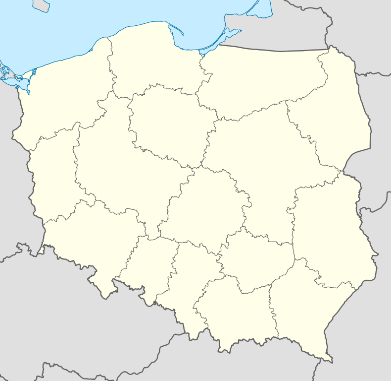
Kościerzyna is located in Gdańsk Pomerania, approximately 50 kilometres (31 miles) south-west of Gdańsk and Tricity and 190 km (118 mi) south-west of Kaliningrad, at an altitude of 163 m (535 ft) above sea level.
History
The history of the town dates back to the end of the 13th century. In 1346 it was granted municipal rights, and around 1350 the settlement obtained the status of a town. After 1310 it was part of the Monastic State of the Teutonic Knights. After the Second Peace of Thorn (1466) the town became part of the province of Royal Prussia incorporated into the Kingdom of Poland.
The town suffered many times from fire. In 1463 it was first plundered and thereafter burned down completely by Poles.[1] In 1626, during the Polish–Swedish War (1626–29), it was completely burned down once more. During the years 1646, 1663 and 1669 it partly burned down, and in 1709 again entirely.[1]
In the First Partition of Poland in 1772 the town was annexed by Kingdom of Prussia. It was administratively in the newly formed province of West Prussia, where it remained until 1919. During the Kashubian diaspora, many families from Kościerzyna such as the Mrozeks, the Pellowskis and the Eichmans emigrated to the area of Winona, Minnesota in the United States, beginning in the late 1850s. Around 1900 Berent had one Protestant church, one Catholic church, a synagogue, a high school, an academy for school teachers, a factory for the production of snuff, several breweries, a refinery, various mills, agriculture and forestry.[2]
After World War I, in January 1920 Kościerzyna was integrated into the Second Polish Republic. After the Nazi invasion of Poland, between, 1939-45 it was part of the Third Reich. After World War II the town was transferred to the People's Republic of Poland.
Number of inhabitants by year
| Year | Number |
|---|---|
| 1772 | 602 |
| 1784 | over 600 |
| 1831 | 1,592 |
| 1875 | 4,138[3] |
| 1880 | 4.238[3] |
| 1890 | 4,299 |
| 1900 | 4,910 |
| 1920 | 6,500 |
| 1943 | 8,385 |
| 1960 | 10,900 |
| 1970 | 15,100 |
| 1980 | 18,664 |
| 1990 | 22,663 |
| 2003 | 23,196 |
Tourist attractions
- Skansen Parowozownia Kościerzyna (railway museum) located at Towarowa 7 Street.[4]
- Lake Galezne [5]
- Sanctuary [6]
Sports
- Kaszubia Kościerzyna - football club
Notable residents
- Stanisław Ernest Denhoff (c. 1673–1728), Field Hetman of Lithuania, Voivode of Polotsk
- Abraham Lissauer (1832–1908), physician
- Gustav Flatow (1875–1945), athlete
- Aleksander Majkowski (1876-1938), writer and poet
- Hugo Neumann (1882–1962), politician and writer
International relations
Twin towns — sister cities
Kościerzyna is twinned with:
See also
- Kościerzyna (PKP station)
External links
- (Polish) Municipal website
- (Polish) Twin cities of Kościerzyna
- (Polish) Photogalleries of Kościerzyna's twin cities
- Some German-language documents regarding population
Gallery
-

City Hall
-

Railway Museum in Kościerzyna
-

View from train station in Kościerzyna
-

Retro train "Costerina" Gdynia - Kościerzyna
-

Marketplace
References
- ↑ 1.0 1.1 Johann Friedrich Goldbeck: Volständige Topographie des Königreichs Preußen. Part II, Marienwerder 1789, pp. 66–67, no. 5.
- ↑ Meyers Großes Konversations-Lexikon, 6th edition, Vol. 2, Leipzig and Vienna 1906, p. 656.
- ↑ 3.0 3.1 Michael Rademacher: Deutsche Verwaltungsgeschichte Provinz Westpreußen, Kreis Berent (2006).
- ↑ Interesting article with photos on this museum (in Polish)
- ↑ See an article with photos describing the lake (in Polish)
- ↑ Article on the Sanctuary. See also Sanctuary's website
Coordinates: 54°07′N 17°59′E / 54.117°N 17.983°E
| ||||||||||||


