Kiyapadu, Rayagada
| Kiyapadu | |
|---|---|
| village | |
 | |
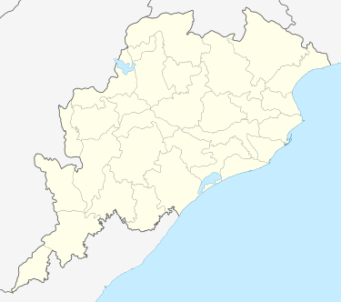 Kiyapadu Location in Odisha, India | |
| Coordinates: 19°35′00″N 83°22′00″E / 19.58333°N 83.36667°ECoordinates: 19°35′00″N 83°22′00″E / 19.58333°N 83.36667°E | |
| Country |
|
| State | Odisha |
| District | Rayagada |
| Government | |
| • Type | Democratic |
| Elevation | 229 m (751 ft) |
| Languages | |
| • Official | Oriya |
| Time zone | IST (UTC+5:30) |
| PIN | 765002 |
| Telephone code | 06855 |
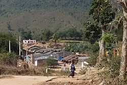
Kiyapadu is a small village(hamlet) in Rayagada Tahasil of Gumma Panchayat in the state of Odisha, India dominated by Dongaria Tribe. The village was in lime light when the local people opposed the establishment of the Alumina Refinery by RSB.[1][2][3]
Geography
Kiyapadu is situated about 329 km from the district headquarters i.e. Rayagada. Kiyapadu is situated at Lat.19° 35′N and Lon. 83° 22′E.
Demography
Majority of the population at and nearby Kiyapadu are primitive tribal. As per census 2011 available in the "Official website of census india" the population of village is 297 of which 144 are males and 153 are females as per Population Census 2011[4]
Tourist attractions
The village is surrounded by hillocks. The nearest place of tourist interest is Rayagada.
References
External links
| ||||||||||||||