Kiwaatule
| Kiwaatule | |
|---|---|
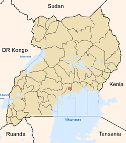
 Kiwaatule Location in Kampala | |
| Coordinates: 00°21′56″N 32°37′31″E / 0.36556°N 32.62528°E | |
| Country |
|
| Region | Central Uganda |
| District | Kampala Capital City Authority |
| Division | Nakawa Division |
| Elevation | 4,000 ft (1,220 m) |
Kiwaatule is a township within the city of Kampala, Uganda's capital.
Location
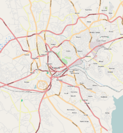
Kiwaatule is bordered by Najjera to the north, Naalya to the east, Banda to the south, Ntinda to the southwest, Kigoowa to the west and Kulambiro to the northwest. This location is approximately 12 kilometres (7.5 mi), by road, northeast of Kampala's central business district.[1] The coordinates of Kiwaatule are:0°21'56.0"N, 32°37'31.0"E (Latitude:0.365556; Longitude:32.625275).[2]
Overview
Kiwatule is mainly a middle class residential neighborhood with a smattering of commercial establishments The Kampala Northern Bypass Highway traverses the neighborhood as it courses its way from Naalya to the east towards Kulambiro and Kigoowa to the west. The People's Progressive Party (PPP), one of the political parties in Uganda, maintains its headquarters at Kiwaatule.
Points of interest
The following points of interest are located in or near Kiwaatule:
- The Kampala Northern Bypass Highway
- Sunset Apartment Complex - A condominium and apartment development by National Housing and Construction Company
- The national headquarters of the People's Progressive Party - One of the political parties in Uganda
See also
References
- ↑ "Map Showing Distance Between Central Kampala And Kyambogo Which Is Next To Kiwaatule". Globefeed.com. Retrieved 17 June 2014.
- ↑ Google, . "Location of Kiwaatule At Google Maps". Google Maps. Retrieved 17 June 2014.