Kitaibaraki, Ibaraki
| Kitaibaraki 北茨城市 | ||
|---|---|---|
| City | ||
| ||
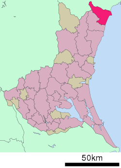 Location of Kitaibaraki in Ibaraki Prefecture | ||
 Kitaibaraki Location in Japan | ||
| Coordinates: 36°47′57″N 140°45′16″E / 36.79917°N 140.75444°ECoordinates: 36°47′57″N 140°45′16″E / 36.79917°N 140.75444°E | ||
| Country | Japan | |
| Region | Kantō | |
| Prefecture | Ibaraki Prefecture | |
| Government | ||
| • Mayor | Minoru Toyoda (since December 1990) | |
| Area | ||
| • Total | 186.55 km2 (72.03 sq mi) | |
| Population (May 1, 2011) | ||
| • Total | 46,465 | |
| • Density | 250/km2 (650/sq mi) | |
| Time zone | Japan Standard Time (UTC+9) | |
| Symbols | ||
| - Tree | Pinus | |
| - Flower | Rhododendron ponticum | |
| - Bird | Larus canus | |
| - Fish | Monkfish | |
| Address |
Isohara-chō, Isohara 1630, Kitaibaraki City, Ibaraki Prefecture (茨城県北茨城市磯原町磯原1630番地) 319-1592 | |
| Phone number | 81(0)293-43-1111 | |
| Website |
www | |

Kitaibaraki (北茨城市 Kitaibaraki-shi) is a city located on the Pacific Ocean in Ibaraki Prefecture, Japan, between the cities of Hitachi and Iwaki.
As of May 1, 2011, the city has an estimated population of 46,465, with 17,438 households and a population density of 249.08 persons per km². The total area is 186.55 km².
The city was founded on March 31, 1956 as the fifteenth city in Ibaraki Prefecture is located in the northernmost part of the Prefecture. Neighboring Takahagi to the south and Iwaki City of Fukushima Prefecture to the Northwest. Approximately 80% of the total area is mountainous forest. The eastern region is low ground facing the ocean with spacious open flatland along the Okita and Satone Rivers. Agriculture and fishing have been prominent since ancient times. But with the discovery of coal power, it became centered on the Joban Coal Field.
The city name means 'Kita' is that 'North', and 'Ibara' is meaning 'Rose' or literary 'Brier', also 'ki' is a 'Castle'. Kitaibaraki-shi means the North Rose Castle City.
It was seriously affected by the tsunami from the 2011 Tōhoku earthquake.[1]
Commerce
Commerce developed during the Edo period along the Tanagura highway, which was also called the 'Road of Salt'. The area flourished with ports for water transportation and coal mining began at the end of the Edo period. The coal industry thrived in the Meiji period (1868–1912), leading at the opening of the Joban line (1897) to transport coal, and Isohara station flourished. Furthermore, a fisheries school was established in Otsu Port.
Popular Attractions
Kitaibaraki is well known for its variety of seafood. Two ports, Hirakata and Otsu, bring in fresh catches daily. A popular winter dish is Anko-nabe, a hot pot consisting of Angler fish and vegetables.
Near to Otsu port is the scenic Istuura coastline. This area is famous for Rokkakudo, a six sided red house built by Tenshin Okakura. The Tenshin Memorial Museum, with regularly updated exhibits, offers visitors a glance at various schools of Japanese art.
A glass workshop sits on top of Mount Akane, in the town of Hanakawa. The workshop, called Silica, is named after silica sand, which is what glass is made from. Visitors to Silica can try their hand at making various objects, such as vases or glass cups.
Festivals
Kitaibaraki has many festivals handed down from ancient times. The Sasara of Hanazono Shrine is a Shishi Mai (ritual dance with a lion's mask) with a 900 year-tradition. This dance can be seen yearly on May 5 at the Hanazono Shrine.
The Ofuna-Matsuri, the seafarer's festival, is held only once every five years. The first weekend in May, the festival is a prayer for large fish catches and protection from the clutches of the sea. A decorated ship is pulled by the seamen through the town toward a Shinto shrine. Last held on May 3, 2009, the next will be in 2014.
August 16 is the last day of Obon (festival of the dead). On this day around 6 a.m., families celebrating Obon for the first time gather at Otsu Port for Bonbune Nagashi. Miniature fishing boats laden with vegetables are paraded in the port, and afterwards lanterns are let out to see in order to guide home the spirits of the dead.
A recent addition to Kitaibaraki's festival culture is the Kitaibaraki Citizen's Festival, held yearly on the last Saturday of August. There is a dance contest and fireworks.
The 'Ujo no Sato Minato Matsuri' (port festival) is held in the beginning of November at Otsu Port. There are various cultural exhibits along with food and game stalls. There is also a demonstration of how to carve an angler fish.
Transportation
Kitaibaraki is located on the Joban Line and Joban Expressway, both of which connect it to Tokyo, Mito and Iwaki. The Kitaibaraki exit of the Joban expressway gets off in the town of Isohara. The closest airport is a which of Fukushima Airport or Ibaraki Airport.
Route 6, a popular trucker route from Sendai to Tokyo, also goes down through Kitaibaraki, but is often plagued with traffic.
There are three train stations in Kitaibaraki, all of which on the Joban train line. Ōtsukō Station, the farthest north, is in the town of Otsu. Isohara Station, the biggest of the three stations, is your best bet to catch a Super Hitachi train north or south. A Super Hitachi train from Isohara station to Ueno station takes roughly 2 hours.
There are also various bus lines.
Sister City
Kitaibaraki's sister city is Wairoa, in the Wairoa District of New Zealand. Secondary school students undertake regular exchanges between New Zealand and Japan.
References
- ↑ http://www.comcast.net/slideshow/news-toppix0307/8/ Kita Ibaraki
External links
![]() Media related to Kitaibaraki, Ibaraki at Wikimedia Commons
Media related to Kitaibaraki, Ibaraki at Wikimedia Commons
- Kitaibaraki City official website (Japanese)
| ||||||||||||||||||||||||||||||||||||