Kita-ku, Niigata
| Kita-ku 北区 | |
|---|---|
| Ward | |
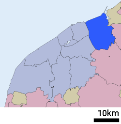 Location of Kita-ku in Niigata | |
 Kita-ku Location in Japan | |
| Coordinates: 37°54′59″N 139°13′7″E / 37.91639°N 139.21861°ECoordinates: 37°54′59″N 139°13′7″E / 37.91639°N 139.21861°E | |
| Country | Japan |
| Region | Chūbu |
| Prefecture | Niigata |
| Area | |
| • Total | 107.92 km2 (41.67 sq mi) |
| Population (February 1, 2012) | |
| • Total | 77,215 |
| • Density | 715/km2 (1,850/sq mi) |
| Time zone | Japan Standard Time (UTC+9) |
| Symbols | |
| - Tree | Willow |
| - Flower | Tulip |
| Address |
1-602-1 Gakkōchō-dōri, Chūō-ku, Niigata-shi, Niigata-ken 951-8550 |
Kita-ku (北区 lit. "northern ward") is one of the eight wards of Niigata City, Niigata Prefecture, Japan. The ward was created on April 1, 2007 when Niigata became a government-designated city. It is composed of the Niigata City north district and the former city of Toyosaka.
Niigata Racecourse, one of the racecourses of JRA, is located in the ward.
External links
![]() Media related to Kita-ku, Niigata at Wikimedia Commons
Media related to Kita-ku, Niigata at Wikimedia Commons
- Niigata official website (Japanese)
- Niigata Kita-ku website (Japanese)
- Kita-ku, Niigata Map
- Niigata Map
| |||||||||||||||||||||