Kita-Toda Station
Kita-Toda Station 北戸田駅 | |
 | |
|---|---|
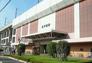
| West entrance of the station, September 2007 | |
| Location | |
| Prefecture | Saitama (See other stations in Saitama) |
| City | Toda |
| Neighborhood etc. | Niizo |
| Postal code | 335-0021 |
| (in Japanese) | 埼玉県戸田市大字新曽 |
| History | |
| Year opened | 1985 |
| Rail services | |
| Operator(s) | JR East |
| Line(s) | Saikyō Line |
| Statistics | 17,133 passengers/day (FY2011) |
Kita-Toda Station (北戸田駅 Kita-Toda-eki) is a railway station on the Saikyō Line in Toda, Saitama, Japan, operated by the East Japan Railway Company (JR East).[1]
Lines
Kita-Toda Station is served by the Saikyō Line which runs between Ōsaki in Tokyo and Ōmiya in Saitama Prefecture. Some trains continue northward to Kawagoe via the Kawagoe Line and southward to Shin-Kiba via the TWR Rinkai Line. The station is located 13.7 km north of Ikebukuro Station.[2] The station identification colour is "orange".[2]
Station layout
The station consists of one elevated island platform serving two tracks. The tracks of the Tōhoku Shinkansen also run adjacent to this station, on the west side.[2]
Platforms
| 1 | ■Saikyō Line | for Akabane, Shinjuku, and Ōsaki Rinkai Line for Shin-Kiba |
| 2 | ■Saikyō Line | for Musashi-Urawa, Ōmiya, and Kawagoe |
An arrangement of the Toda City song has been used as the departure melody for trains departing from the up platform (platform 1) since 1 August 2007.[3]
Adjacent stations
| « | Service | » | ||
|---|---|---|---|---|
| Saikyō Line | ||||
| Commuter rapid: no stop | ||||
| Rapid: no stop | ||||
| Toda | Local | Musashi-Urawa | ||
History
Kita-Toda Station opened on 30 September 1985.[2]
Passenger statistics
In fiscal 2011, the station was used by an average of 17,133 passengers daily (boarding passengers only).[4]
The passenger figures for previous years are as shown below.
| Fiscal year | Daily average |
|---|---|
| 2000 | 14,125[5] |
| 2005 | 14,505[6] |
| 2010 | 16,583[7] |
| 2011 | 17,133[4] |
Surrounding area

- Aeon Mall Kita-Toda
- National Route 298
Schools
- Saitama Prefectural Nanryo High School[8]
- Saitama Municipal Urawa Minami High School[9]
- Saitama Municipal Tsuji Elementary School[10]
- Toda Municipal Ashihara Elementary School[11]
See also
References
- ↑ 各駅情報(北戸田駅) [Station Information: Kita-Toda Station] (in Japanese). East Japan Railway Company. Retrieved 30 October 2012.
- ↑ 2.0 2.1 2.2 2.3 Kawashima, Ryozo (March 2011). 日本の鉄道 中部ライン 全線・全駅・全配線 第12巻 東京都心北部 [Railways of Japan - Chubu Line - Lines/Stations/Track plans - Vol 12 Northern Central Tokyo]. Japan: Kodansha. p. 17-52. ISBN 978-4-06-270072-6.
- ↑ 戸田市歌「ああ わが戸田市」の発車メロディーが駅で流れます! [Toda City Song used as station departure melody]. Official website (in Japanese). Japan: Toda City. 26 July 2007. Retrieved 19 November 2012.
- ↑ 4.0 4.1 各駅の乗車人員 (2011年度) [Station passenger figures (Fiscal 2011)] (in Japanese). Japan: East Japan Railway Company. Retrieved 30 October 2012.
- ↑ 各駅の乗車人員 (2000年度) [Station passenger figures (Fiscal 2000)] (in Japanese). Japan: East Japan Railway Company. Retrieved 30 October 2012.
- ↑ 各駅の乗車人員 (2005年度) [Station passenger figures (Fiscal 2005)] (in Japanese). Japan: East Japan Railway Company. Retrieved 30 October 2012.
- ↑ 各駅の乗車人員 (2010年度) [Station passenger figures (Fiscal 2010)] (in Japanese). Japan: East Japan Railway Company. Retrieved 30 October 2012.
- ↑ Saitama Prefectural Nanryo High School website Retrieved 30 October 2012. (Japanese)
- ↑ Saitama Municipal Urawa Minami High School website Retrieved 30 October 2012. (Japanese)
- ↑ Saitama Municipal Tsuji Elementary School website Retrieved 30 October 2012. (Japanese)
- ↑ Toda Municipal Ashihara Elementary School website Retrieved 30 October 2012. (Japanese)
External links
| Wikimedia Commons has media related to Kita-Toda Station. |
- Kita-Toda Station information (JR East) (Japanese)
- Kita-Toda Station information (Saitama Prefectural Government) (Japanese)
| ||||||
Coordinates: 35°49′38.83″N 139°39′37.10″E / 35.8274528°N 139.6603056°E