Kirghiz Soviet Socialist Republic
| Kirghiz Soviet Socialist Republic | ||||||
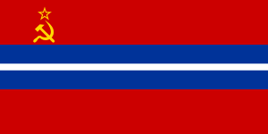
| Киргизская Советская Социалистическая Республика Кыргыз Советтик Социалисттик Республикасы Kyrgyz Sovettik Sotsialisttik Respublikasy | ||||||
| ||||||
| ||||||
| Anthem Anthem of the Kirghiz Soviet Socialist Republic | ||||||
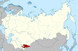 Location of the Kirghiz SSR (red) within the Soviet Union. | ||||||
| Capital | Frunze (Bishkek) | |||||
| Languages | ||||||
| Government | Soviet Socialist Republic | |||||
| History | ||||||
| - | Established | 1936 | ||||
| - | Disestablished | 1991 | ||||
| Area | ||||||
| - | 1989 | 198,500 km² (76,641 sq mi) | ||||
| Population | ||||||
| - | 1989 est. | 4,257,800 | ||||
| Density | 21.4 /km² (55.6 /sq mi) | |||||
| Calling code | +7 319/331/332/334/335 | |||||
| Today part of | | |||||

The Kirghiz Soviet Socialist Republic (Kyrgyz: Кыргыз Советтик Социалисттик Республикасы Kyrgyz Sovettik Sotsialisttik Respublikasy; Russian: Киргизская Советская Социалистическая Республика Kirgizskaya Sovetskaya Sotsialisticheskaya Respublika), also known as the Kirghiz SSR, the Kyrgyz SSR, or, most commonly, Kirghizia, was one of the constituent republics of the Soviet Union (USSR). In 1991, it was transformed into independent Kyrgyzstan.
History
Established on 14 October 1924 as the Kara-Kirghiz Autonomous Oblast of the RSFSR, it was transformed into the Kirghiz ASSR (Kirghiz Autonomous Socialist Soviet Republic) on 1 February 1926, still being a part of the RSFSR.[1] The borders were not divided however by ethnic or linguistic lines.[2]
On 5 December 1936, with the adoption of the 1936 Soviet Constitution, it became a separate constituent republic of the USSR as the Kirghiz Soviet Socialist Republic during the final stages of the national delimitation in the Soviet Union.[3]
At the time of formation of the Kirghiz SSR, its territory was divided into districts. On November 21, 1939 five oblasts (regions) were created: Jalal-Abad, Issyk Kul, Osh, Tyan Shan, and Frunze Oblasts.<ref name="GSE>Советская Социалистическая Республика Kirghiz Soviet Socialist Republic in the Great Soviet Encyclopedia, 1969–1978 (Russian)</ref>[4] Tien Shan State was abolished in 1962, when rest of the country with the exception of Osh was divided into districts of republican subordination. In 1970, Issyk-Kul and Naryn (formerly Tien Shan) were defined, and in 1980 so was Talas. In 1988, the Naryn and Talas oblasts were again abolished, but in 1990 they were restored. At the same time, Jalal-Abad and Chui (formerly Frunze) were reestablished. These districts were particularly known for their heavy application of fertilizers after independence.[5]
The Osh Massacre in 1990 undermined the position of the first secretary. In 1991, Akayev unequivocally condemned the putsch and gained fame as a democratic leader. The country declared its independence on 31 August 1991. The Soviet Union was formally dissolved on 25 December 1991.[6]
Demographics
In 1926, the Kirghiz Soviet Socialist Republic had a population of 1,002,000 people. In 1939 1,458,000 people were recorded. The population grew significantly in the decades after World War II; the republic had 2,065,837 people in 1959, 2,932,805 people in 1970, and 3,529,030 people in 1979. In the final Soviet census of 1989, the Kirghiz Soviet Socialist Republic had grown to 4,257,755 people.[7] The majority of the population were ethnic Kyrgyz people. However, because large numbers were sent here in deportations, at times there were significant other ethnic groups. Between March and May 1944 alone, it was reported in the Kremlin that 602,193 residents of the North Caucasus region had been deported to the Kirghiz and Kazakh SSRs, of which 496,460 were Chechens and Ingush, 68,327 of which were Karachai and 37,406 were Balkars.[8] The majority of the Kyrgyz population were (as they are today) Muslims, speaking a Turkic language. Bishkek had the largest concentration of Russians in the country, some 22% of the population by independence, with Uzbek minorities in the Fergana Valley especially constituting some 13% of the population. In 1990, violent clashes between Uzbeks and Kyghyz peoples broke out in the Osh Raion; ethnic tension still remains in the region.[9]
See also
References
- ↑ Bennigsen,, Alexandre; Broxup,, Marie (3 June 2014). The Islamic Threat to the Soviet State (Routledge Revivals). Routledge. pp. 42–. ISBN 978-1-317-83171-6.
- ↑ Dana, Leo Paul (1 January 2002). When Economies Change Paths: Models of Transition in China, the Central Asian Republics, Myanmar & the Nations of Former Indochine Française. World Scientific. p. 65. ISBN 978-981-277-745-4.
- ↑ Group, Taylor & Francis (2004). Europa World Year. Taylor & Francis. p. 2543. ISBN 978-1-85743-255-8.
- ↑ Incorporated, Grolier (1993). Encyclopedia Americana. Grolier Incorporated. p. 141.
- ↑ Mudahar, Mohinder S. (1 January 1998). Kyrgyz Republic: Strategy for Rural Growth and Poverty Alleviation. World Bank Publications. p. 86. ISBN 978-0-8213-4326-5.
- ↑ Sakwa, Professor of Russian and Foreign Policy Richard; Sakwa, Richard (17 August 2005). The Rise and Fall of the Soviet Union. Routledge. p. 480. ISBN 978-1-134-80602-7.
- ↑ Pavlenko, Aneta (2008). Multilingualism in Post-Soviet Countries. Multilingual Matters. p. 206. ISBN 978-1-84769-087-6.
- ↑ Tishkov, Valeriĭ Aleksandrovich (15 May 2004). Chechnya: Life in a War-Torn Society. University of California Press. p. 25. ISBN 978-0-520-93020-9.
- ↑ Rubin, Don; Pong, Chua Soo; Chaturvedi, Ravi; Ramendu Majumdar, Minoru Tanokura (January 2001). The World Encyclopedia of Contemporary Theatre: Asia/Pacific. Taylor & Francis. p. 274. ISBN 978-0-415-26087-9.
| |||||||||||||||||||||||||
