Kirby, Arkansas
| Kirby, Arkansas | |
|---|---|
| Census-designated place | |
 Kirby, Arkansas | |
| Coordinates: 34°15′01″N 93°38′29″W / 34.25028°N 93.64139°W | |
| Country | United States |
| State | Arkansas |
| County | Pike |
| Area[1] | |
| • Total | 14.455 sq mi (37.44 km2) |
| • Land | 14.317 sq mi (37.08 km2) |
| • Water | 0.138 sq mi (0.36 km2) |
| Elevation | 663 ft (202 m) |
| Population (2010)[2] | |
| • Total | 786 |
| • Density | 54/sq mi (21/km2) |
| Time zone | Central (CST) (UTC-6) |
| • Summer (DST) | CDT (UTC-5) |
| Area code(s) | 870 |
| GNIS feature ID | 77411[3] |
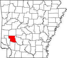
Kirby is an unincorporated census-designated place in northern Pike County, Arkansas, United States. The community lies on U.S. Route 70; it is located halfway between Daisy and Glenwood. As of the 2010 census, its population is 786.[2]
Education
Public education for elementary and secondary school students is provided by the Kirby School District, which includes:
- Kirby Elementary School, serving kindergarten through grade 6.
- Kirby High School, serving grades 7 through 12.
The schools' mascot and athletic teams are the Trojans with maroon and gray as the school colors.
References
- ↑ "US Gazetteer files: 2010, 2000, and 1990". United States Census Bureau. 2011-02-12. Retrieved 2011-04-23.
- ↑ 2.0 2.1 "American FactFinder". U.S. Census Bureau. Retrieved 6 May 2011.
- ↑ U.S. Geological Survey Geographic Names Information System: Kirby, Arkansas
| |||||||||||||||||||||||||||||
Coordinates: 34°15′01″N 93°38′29″W / 34.25028°N 93.64139°W
