Kiomourtzou
| Kiomourtzou | |
|---|---|
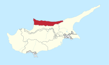
 Kiomourtzou Location in Cyprus | |
| Coordinates: 35°17′33″N 33°15′25″E / 35.29250°N 33.25694°ECoordinates: 35°17′33″N 33°15′25″E / 35.29250°N 33.25694°E | |
| Country |
|
| • District | Kyrenia District |
| Country (controlled by) |
|
| • District | Girne District |
| Population (2011)[1] | |
| • Total | 67 |
| Time zone | EET (UTC+2) |
| • Summer (DST) | EEST (UTC+3) |
Kiomourtzou (Greek: Κιομουρτζιού; Turkish: Kömürcü) is a small village in Cyprus located along the main Kyrenia–Nicosia highway. De facto, it is under the control of Northern Cyprus. Its population in 2011 was 67.
References
- ↑ KKTC 2011 Nüfus ve Konut Sayımı [TRNC 2011 Population and Housing Census], TRNC State Planning Organization, 6 August 2013