Kintetsu Yatomi Station
Kintetsu Yatomi Station 近鉄弥富駅 | |
 | |
|---|---|
| Kintetsu Yatomi Station | |
| Location | |
| Prefecture | Aichi (See other stations in Aichi) |
| City | Yatomi |
| Neighborhood etc. | Uguiura-cho Nishimae Shinden 51 |
| Postal code | 498-0026 |
| (in Japanese) | 愛知県弥富市鯏浦町西前新田51 |
| History | |
| Year opened | 1938 |
| Former names | Kankyu Yatomi Station Sankyu Yatomi Station Kankyu Yatomi Station Kinki-Nippon Yatomi Station |
| Present name since | 1970 |
| Rail services | |
| Operator(s) | Kintetsu |
| Line(s) | Nagoya Line |
| Statistics | 12,124 passengers/day 2008 |
Kintetsu Yatomi Station (近鉄弥富駅 Kintetsu-Yatomi-eki) is a railway station on the Kintetsu Nagoya Line located in Yatomi, Aichi Prefecture, Japan. It is located 16.1 kilometers from the terminus of the Nagoya Line at Kintetsu Nagoya. [1]
History
Kintetsu-Yatomi Station was opened on June 26, 1938 as Kankyu Yatomi Station (関急弥富駅 Kankyu-Yatomi-eki) a station on the Kansai Kyuko Electric Railway, which was acquired by the Sangū Express Electric Railway on January 1, 1940. The station was renamed Sangu-Yatomi Station (参急弥富駅A Sangu-Yatomi-eki) at that time, but reverted to its original name on March 13, 1941. With the merger of Kansai-area railways into the Kintetsu group in 1944,[2] the station was again renamed on June 1, 1944 to Kinki-Nippon Yatomi Station (近畿日本弥富駅 Kinki-Nippon Yatomi-eki). The name was shortened to the present name on March 1, 1970. With the new station building was completed in September 1994.
Line
Layout
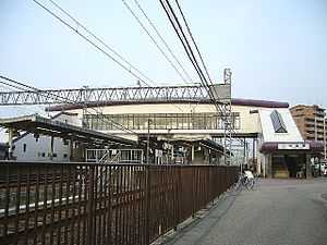
KIntetsu Yatomi Station has a two island platforms connected by an overpass. Entrances are located on the south and the north, on the Kuwana side.
Platforms
| 1, 2 | ■Nagoya Line | for Yokkaichi, Osaka, Kobe and Kashikojima |
| 3, 4 | ■Nagoya Line | for Nagoya |
Adjacent stations
| « | Service | » | ||
|---|---|---|---|---|
| Kintetsu Nagoya Line | ||||
| Sakogi | Local | Kintetsu Nagashima | ||
| Sakogi | Semi-Express | Kintetsu Nagashima | ||
| Kintetsu Kanie | Express | Kuwana | ||
External links
| Wikimedia Commons has media related to Kintetsu-Yatomi Station. |
References
| ||||||
Coordinates: 35°6′49″N 136°43′39.5″E / 35.11361°N 136.727639°E