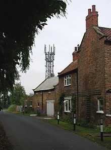
Kilpin
Coordinates: 53°43′59″N 0°49′49″W / 53.733093°N 0.830242°W
Kilpin is a village and civil parish in the East Riding of Yorkshire, England. It is situated approximately 1.5 miles (2.4 km) south-east of Howden and 19 miles (31 km) south-east from the county town of York.

The civil parish is formed by the villages of Kilpin and Kilpin Pike and the hamlets of Balkholme, Belby, Howdendyke and Skelton. Kilpin, with neighbouring settlements Laxton, Saltmarshe and Yokefleet lies within the constituency of Haltemprice and Howden, an area placed as the 10th most affluent in the country in a 2003 Barclays Private Clients survey.[2]
According to the 2011 UK census, Kilpin parish had a population of 339,[1] a decrease on the 2001 UK census figure of 357.[3]
In 1823 Kilpin was in the parish of Howden and the Wapentake and Liberty of Howdenshire. Population at the time was 318, and included four farmers and a yeoman.[4]
References
- ↑ 1.0 1.1 "Key Figures for 2011 Census: Key Statistics: Area: Kilpin CP (Parish)". Neighbourhood Statistics. Office for National Statistics. Retrieved 5 February 2013.
- ↑ "North tops 'real' rich league", BBC News, 14 May 2003. Retrieved 4 July 2014
- ↑ "2001 Census: Key Statistics: Parish Headcounts: Area: Kilpin CP (Parish)". Neighbourhood Statistics. Office for National Statistics. Retrieved 17 May 2008.
- ↑ Baines, Edward (1823): History, Directory and Gazetteer of the County of York, p. 360
- Gazetteer — A–Z of Towns Villages and Hamlets. East Riding of Yorkshire Council. 2006. p. 7.
External links
 Media related to Kilpin at Wikimedia Commons
- Kilpin in the Domesday Book
| ||||||||||||||||||||||||||
