Kilmurry McMahon
| Kilmurry McMahon | |
|---|---|
| Parish | |
 Kilmurry McMahon | |
| Coordinates: 52°39′11″N 9°17′41″W / 52.652958°N 9.29463°WCoordinates: 52°39′11″N 9°17′41″W / 52.652958°N 9.29463°W | |
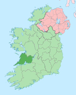
| Country | Ireland |
| Province | Munster |
| County | County Clare |
| Time zone | WET (UTC+0) |
| • Summer (DST) | IST (WEST) (UTC-1) |
| Irish Grid Reference | R258774 |
Kilmurry McMahon (Irish: Cill Mhuire Mhic Mhathuna), also called Kilmurry-Clonderalaw is a civil parish and Catholic parish in the Diocese of Killaloe in County Clare in Ireland.
Location
The Catholic parish of Kilmurry McMahon / Labasheeda is bounded on the south by the Shannon Estuary and by the parishes of Kilmihil on the north, Killimer on the west and Coolmeen (Kilfidane) on the east. It is 30 kilometres (19 mi) west of Ennis. The name derives its name from the church dedicated to Our Lady. The suffix, McMahon, to distinguish it from other Kilmurrys in the county, came from the McMahon clan, who had their main residence at Clonderlaw Castle.[1]
The Catholic parish, in the Roman Catholic Diocese of Killaloe, combines the former parishes of Kilmurry McMahon and Killofin. The population has declined from 7,932 in 1831 to 650 in 2014. The parish has two holy wells, Tullyrcrine well and Mountshannon well.[1]
There are two villages in the parish, Labasheeda and Knock.
Education
There are two primary schools in the parish, Kilmurry McMahon National School and Labasheeda National School. In 2014, Tullycrine National School and Drumdigus National School amalgamated to form Kilmurry McMahon National School, which is located on the site of the old Drumdigus National School. Another primary school at Kilkerin closed in the middle of the last century and has since been demolished.
Religion
There are two Roman Catholic churches in the parish. St. Ciarán's Church is located in the village of Labasheeda while St. Mary's Church is located in the townland of Drumdigus.[2] The former church in the village of Labasheeda is now used as a Community Centre having been previously owned by Shannon Development. A Church of Ireland church was located in the graveyard at Kilmurry East but was demolished in 1965. There is also a graveyard in Kilofin, while there is a famine grave located in the townland of Carrowniska South. There is also a children's grave called Lios na Leanai, in the townland of Tullycreen Lower.
Townlands
Townlands of the civil parish of Kilmurry-Clonderalaw are Ballycurraun, Binvoran, Bleanmore, Breaghva, Carrowbane, Carrowniska North, Carrowniska South, Cassarnagh, Clonderalaw, Cross Beg, Cross More, Derreen, Derrybrick, Derrynalecka, Drumdigus, Kilmore, Kilmurry East, Kilmurry West, Kinlea, Knock, Knockaderreen, Knocknahooan, Lisheenydeen, Prospect, Tullycreen Lower and Tullycreen Upper.[3]
Townlands of the civil parish of Killofin are Ballina, Ballyartney, Ballygeery East, Ballygeery West, Bohyodaun, Cloonarass, Cloonkeery East, Cloonkeery West, Colmanstown, Cullenagh, Kilkerin, Killofin, Knockphutteen, Lakyle North, Lakyle South, Mount Shannon East, Mount Shannon West and Slievedooley.[4]
References
Citations
Sources
- "Kilmurry McMahon". Diocese of Killaloe. Retrieved 2014-03-31.
- "Kilmurry McMahon Churches". Diocese of Killaloe. Retrieved 2014-04-02.
- "Map of Kilmurry-Clonderalaw Parish showing Townlands". Clare County Library. Retrieved 2014-04-02.
- "Map of Killofin Parish showing Townlands". Clare County Parish. Retrieved 2014-04-02.
| ||||||||||||||||||||||||||||||
| ||||||||||||||||||
| ||||||||||||||||||||||||||||||||||||||||||||||||||||||