Kilis
| Kilis | |
|---|---|
| Municipality | |
|
Kilis city center | |
 Kilis | |
| Coordinates: 36°43′N 37°07′E / 36.717°N 37.117°ECoordinates: 36°43′N 37°07′E / 36.717°N 37.117°E | |
| Country | Turkey |
| Province | Kilis |
| Government | |
| • Mayor | Hasan Kara (AKP) |
| Area[1] | |
| • District | 575.18 km2 (222.08 sq mi) |
| Population (2012)[2] | |
| • Urban | 85,119 |
| • District | 99,056 |
| • District density | 170/km2 (450/sq mi) |
| Website |
www |

Kilis is a city in south-central Turkey near the border with Syria and administrative centre of Kilis Province.
History and Population
Kilis is a Turkish city and Kilis was part of the Aleppo Vilayet of the Ottoman Empire until the First World War After which it passed to the Republic of Turkey. There was also a Armenian and Jewish community.[3]
The population of the town was 20,000 in 1927, 45,000 in 1970, 60,000 in 1980 and 85,000 in 1990. It then fell in the 1990s to 70,000 by 2000. The population was 82,109 in 2010.
Being a border town, Kilis has long had a reputation for smuggling and drug trafficking and although this has apparently been reduced, even today cigarettes, spirits and cheap electrical items can be bought for cash at low prices.
The local kebab known as Kilis Kebabi is renowned, and also the breads, baklava and stuffed vegetables.
Geography
Kurd Mountains or Kurd-Dagh (Kurdish: Çiyayê Kurmênc, چیای کورمنج; Arabic: جبل الكرد Jabal al-Kurd; Turkish: Kurt Dağı), also called Aleppo Mountain (Arabic: جبل حلب Jabal Ḥalab), is a highland region in northwestern Syria and southeastern Turkey. It is located in the Aleppo Governorate of Syria and Kilis Province of Turkey. Kurd Mountains are part of the Limestone Massif of northwestern Syria. The mountains are a southern continuation into the Aleppo plateau of the highlands on the western part of the Aintab plateau. The valley of River Afrin surrounds Kurd Mountains from east and south and separates it from the plain of Aʻzāz and Mount Simeon to the east, and from Mount Harim to the south. The valley of River Aswad separates Mount Kurd from Mount Amanus to the west.Sherefname(1543 - 1599) asserts that the authority of Kurdish beys of the region was extended to localities in Antakya. In areas in the plains such as Islahiye, Kırıkhan, Reyhanlı, and Kilis, there are vestiges of Kurdish concentration in Kurd-Dagh.While other regions populated by Kurds in Syria faced an influx of Arab immigrants and the campaign of Arabization beginning in 1960s,The Turkish part was renamed officially as Kurt Dağı ("Wolf Mountain"), with a pun on the Turkish words Kürt (Kurd) and kurt (wolf).The Kurdish names of most of this region's villages were changed to turkish as part of the process of turkifization. The Öncüpınar Syrian border crossing is 5 km (3 mi) to the south and the large city of Gaziantep is 60 km (37 mi) to the north. Indeed until 1996 Kilis was a district of Gaziantep, being made into a province by Tansu Çiller following an open vote-winning gambit in the 1995 general election.
Climate
Kilis has a hot summer Mediterranean climate (Köppen climate classification Csa), with very hot, dry and long summers and cool and rainy winters, with occasional snowfall.
| Climate data for Kilis | |||||||||||||
|---|---|---|---|---|---|---|---|---|---|---|---|---|---|
| Month | Jan | Feb | Mar | Apr | May | Jun | Jul | Aug | Sep | Oct | Nov | Dec | Year |
| Record high °C (°F) | 20.9 (69.6) |
22.5 (72.5) |
28.8 (83.8) |
35.4 (95.7) |
40.2 (104.4) |
41.0 (105.8) |
44.2 (111.6) |
45.0 (113) |
41.4 (106.5) |
36.4 (97.5) |
29.6 (85.3) |
25.7 (78.3) |
45 (113) |
| Average high °C (°F) | 9.7 (49.5) |
11.4 (52.5) |
15.9 (60.6) |
21.2 (70.2) |
27.3 (81.1) |
32.6 (90.7) |
36.0 (96.8) |
36.0 (96.8) |
32.6 (90.7) |
26.3 (79.3) |
17.8 (64) |
11.4 (52.5) |
23.18 (73.72) |
| Average low °C (°F) | 2.2 (36) |
3.1 (37.6) |
6.0 (42.8) |
10.0 (50) |
14.4 (57.9) |
18.4 (65.1) |
21.2 (70.2) |
21.2 (70.2) |
18.6 (65.5) |
14.3 (57.7) |
8.2 (46.8) |
3.8 (38.8) |
11.78 (53.22) |
| Record low °C (°F) | −11.0 (12.2) |
−8.4 (16.9) |
−6.8 (19.8) |
−1.3 (29.7) |
5.4 (41.7) |
10.0 (50) |
14.6 (58.3) |
13.2 (55.8) |
10.2 (50.4) |
1.5 (34.7) |
−3.5 (25.7) |
−8.0 (17.6) |
−11 (12.2) |
| Average precipitation mm (inches) | 84.8 (3.339) |
73.7 (2.902) |
69.2 (2.724) |
49.9 (1.965) |
25.5 (1.004) |
7.4 (0.291) |
1.2 (0.047) |
2.8 (0.11) |
5.9 (0.232) |
33.8 (1.331) |
58.4 (2.299) |
88.1 (3.469) |
500.7 (19.713) |
| Avg. rainy days | 12 | 11 | 11 | 9 | 6 | 2 | 0 | 0 | 2 | 5 | 8 | 12 | 78 |
| Average relative humidity (%) | 71 | 69 | 63 | 60 | 52 | 40 | 34 | 35 | 43 | 54 | 64 | 70 | 54.6 |
| Mean monthly sunshine hours | 130.2 | 140.0 | 195.3 | 231.0 | 288.3 | 339.0 | 359.6 | 344.1 | 300.0 | 235.6 | 168.0 | 120.9 | 2,852 |
| Source #1: Devlet Meteoroloji İşleri Genel Müdürlüğü | |||||||||||||
| Source #2: Weather2 | |||||||||||||
Education
Kilis 7 Aralık University is located in Kilis and has around 8000 undergraduate and graduate students from all around the world. More information about Kilis 7 Aralık University can be found at http://www.kilis.edu.tr/english/
 Kilis 7 Aralık University Main Gate | | 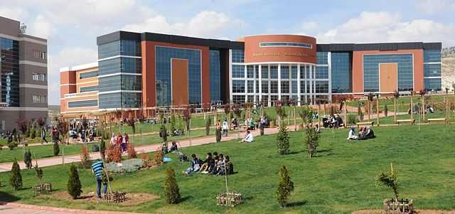 Kilis 7 Aralık University,a Higher Education Institution located in Kilis, Turkey |
Places of interest
Sights in the town include a number of Ottoman era mosques and stone houses with courtyards and elaborate carved wooden fittings.
See also
- See Kilis Province for more information about the area.
References
- ↑ "Area of regions (including lakes), km²". Regional Statistics Database. Turkish Statistical Institute. 2002. Retrieved 2013-03-05.
- ↑ "Population of province/district centers and towns/villages by districts - 2012". Address Based Population Registration System (ABPRS) Database. Turkish Statistical Institute. Retrieved 2013-02-27.
- ↑ Avotaynu: the international review of Jewish genealogy, Volume 14, G. Mokotoff, 1998, p. 40.
