Khirbet Selm
| Khirbet Selm خربت سلم | |
|---|---|
| village | |
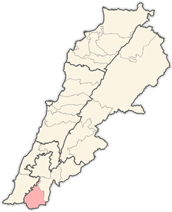
 Khirbet Selm Location within Lebanon | |
| Coordinates: 33°13′45″N 35°25′00″E / 33.22917°N 35.41667°ECoordinates: 33°13′45″N 35°25′00″E / 33.22917°N 35.41667°E | |
| Country |
|
| Governorate | Nabatieh Governorate |
| District | Bint Jbeil District |
| Elevation | 438 m (1,437 ft) |
| Time zone | EET (UTC+2) |
| • Summer (DST) | EEST (UTC+3) |
| Dialing code | +961 |
Kherbet Selm is a village in southern Lebanon.
The municipality of Khirbet Selm is located in the Kaza of Bent Jbayl one of is one of the eight mohafazats (governorates) of Lebanon. Khirbet Selm is 104 kilometers (64.6256 mi) away from Beirut the capital of Lebanon. It's elevations is of 630 meters (2067.03 ft - 688.968 yd) above sea level. Khirbet Selm surface stretches for 379 hectares (3.79 km² - 1.46294 mi²).[1]
References
| |||||||||||||||||||||
