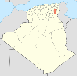
Khenchela Province
Khenchela Province (Arabic: ولاية خنشلة) is a province (wilaya) of Algeria.
Administrative division
The province is divided into 8 districts, which are further divided into 21 communes or municipalities.
Districts
- Khenchela, as a district and capital
- Aïn Touila, located 20 kilometres (12 mi) northeastern of capital
- Babar, located 30 kilometres (19 mi) south of capital
- Bouhmama, located 35 kilometres (22 mi) west of capital
- Chechar, located 50 kilometres (31 mi) south of capital
- El Hamma, located 7 kilometres (4.3 mi) west of capital
- Kaïs, located 22 kilometres (14 mi) west of capital
- Ouled Rechache, located 22 km east of capital
Communes
References
- ↑ Office National des Statistiques, Recensement General de la Population et de l’Habitat 2008 Preliminary results of the 2008 population census. Accessed on 2008-07-02.