Khan Bebin
| Khan Bebin خان ببين | |
|---|---|
| city | |
 Khan Bebin | |
| Coordinates: 37°02′14″N 55°03′01″E / 37.03722°N 55.05028°ECoordinates: 37°02′14″N 55°03′01″E / 37.03722°N 55.05028°E | |
| Country |
|
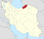
| Province | Golestan Province |
| County | Ramian |
| Bakhsh | Fenderesk |
| Elevation | 67 m (220 ft) |
| Population (2006) | |
| • Total | 10,435 |
| Time zone | IRST (UTC+3:30) |
| • Summer (DST) | IRDT (UTC+4:30) |
| Khan Bebin at GEOnet Names Server | |
Khan Bebin (Persian: خان ببين, also Romanized as Khān Bebīn and Khān Beben, Khān Behbīn, Khanbeh Bon', also known as Khān Bīn)[1] is a city in Fenderesk District, in Ramian County in Golestan Province, in northern Iran. At the 2006 census, its population was 10,435, in 2,561 families.[2]
Centrally located within the Fenderesk District of Golestan Province,[3] Khanbehbin is close to the Shir-Abad Waterfall.
References
- ↑ Khan Bebin can be found at GEOnet Names Server, at this link, by opening the Advanced Search box, entering "-3070536" in the "Unique Feature Id" form, and clicking on "Search Database".
- ↑ "Census of the Islamic Republic of Iran, 1385 (2006)" (Excel). Islamic Republic of Iran. Archived from the original on 2011-11-11.
- ↑ Rabino, Hyacinth Lois (1928). Mazandaran and Astarabad. London. pp. 82, 128.
External links
- Khanbehbin entry in the Dehkhoda Dictionary (Persian)
- Khanbehbin map
- Khanbehbin geographical map
| ||||||||||||||||||||||||||||||||||||||||||||||||||||||||||||||||||||||
| ||||||||||||||||||||||||||||