Khaen Dong District
| Khaen Dong แคนดง | |
|---|---|
| Amphoe | |
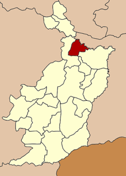 Amphoe location in Buriram Province | |
| Coordinates: 15°18′36″N 103°7′24″E / 15.31000°N 103.12333°ECoordinates: 15°18′36″N 103°7′24″E / 15.31000°N 103.12333°E | |
| Country |
|
| Province | Buriram |
| Seat | Khaen Dong |
| Area | |
| • Total | 298.0 km2 (115.1 sq mi) |
| Population (2005) | |
| • Total | 31,908 |
| • Density | 107.1/km2 (277/sq mi) |
| Time zone | THA (UTC+7) |
| Postal code | 31150 |
| Geocode | 3122 |
Khaen Dong (Thai: แคนดง) is a district (Amphoe) in the northern part of Buriram Province, northeastern Thailand.
Geography
Neighboring districts are (from the east clockwise) Satuek, Ban Dan and Khu Mueang of Buriram Province and Chumphon Buri of Surin Province.
History
The minor district (King Amphoe) was established on July 1, 1997, when it was split off from Satuek district.[1]
Following a decision of the Thai government on May 15, 2007, all of the 81 minor districts were to be upgraded to full districts.[2] With the publishing in the Royal Gazette on August 24 the upgrade became official.[3]
Administration
The district is subdivided into 4 subdistricts (tambon), which are further subdivided into 61 villages (muban). Khaen Dong is a township (thesaban tambon) which covers parts of tambon Khaen Dong. There are also 4 Tambon administrative organizations (TAO).
| No. | Name | Thai name | Villages | Inh. | |
|---|---|---|---|---|---|
| 1. | Khaen Dong | แคนดง | 25 | 11,990 | |
| 2. | Dong Phlong | ดงพลอง | 13 | 6,603 | |
| 3. | Sa Bua | สระบัว | 12 | 5,921 | |
| 4. | Hua Fai | หัวฝาย | 11 | 7,394 |
References
- ↑ ประกาศกระทรวงมหาดไทย เรื่อง แบ่งเขตท้องที่อำเภอสตึก จังหวัดบุรีรัมย์ ตั้งเป็นกิ่งอำเภอแคนดง. Royal Gazette (in Thai) 114 (Special 51 ง): 13. June 25, 1997.
- ↑ แถลงผลการประชุม ครม. ประจำวันที่ 15 พ.ค. 2550 (in Thai). Manager Online.
- ↑ พระราชกฤษฎีกาตั้งอำเภอฆ้องชัย...และอำเภอเหล่าเสือโก้ก พ.ศ. ๒๕๕๐. Royal Gazette (in Thai) 124 (46 ก): 14–21. August 24, 2007.