Kfar Sirkin
| Kfar Sirkin כְּפַר סִירְקִין | |
|---|---|
|
Water tower | |
 Kfar Sirkin | |
| Coordinates: 32°4′36.26″N 34°55′25.48″E / 32.0767389°N 34.9237444°ECoordinates: 32°4′36.26″N 34°55′25.48″E / 32.0767389°N 34.9237444°E | |
| Council | Southern Sharon |
| Region | Southern Sharon plain/Gush Dan |
| Founded | 1933 |
| Website | http://www.kfarsirkin.org.il/ |

Kfar Sirkin or Kefar Syrkin (Hebrew: כְּפַר סִירְקִין) is a moshav in Israel within the municipal jurisdiction of the Drom HaSharon Regional Council near the city of Petah Tikva. Founded in 1933, it was named after the famous Zionist Nachman Syrkin.
Kfar Sirkin served as a Jewish stronghold in the 1936–1939 Arab revolt in Palestine. The Haganah used the village to fight off attacking Arab forces and to store weapons which were illegal under the British Mandate rule of the time.
Today, the village is agricultural. A military base of the Israel Defense Forces is located to the north and west of the village.
-
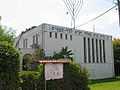
Local synagogue
-
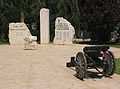
Memorial to residents who fell in the line of duty
-
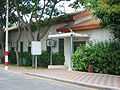
Main office of the moshav
External links
| ||||||||||||||||||||||||||