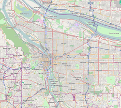
Kerns, Portland, Oregon
| Kerns | |
|---|---|
| Neighborhood | |
 Kerns | |
|
Coordinates: 45°31′35″N 122°38′38″W / 45.5265°N 122.64393°WCoordinates: 45°31′35″N 122°38′38″W / 45.5265°N 122.64393°W PDF map | |
| Country | United States |
| State | Oregon |
| City | Portland |
| Government | |
| • Association | Kerns Neighborhood Association |
| • Coalition | Southeast Uplift Neighborhood Program |
| Area | |
| • Total | 0.83 sq mi (2.14 km2) |
| Population (2000)[1] | |
| • Total | 5,095 |
| • Density | 6,170/sq mi (2,381/km2) |
| Housing[1] | |
| • No. of households | 2915 |
| • Occupancy rate | 94% occupied |
| • % households renting | 81% renting |
| • Avg. household size | 1.75 persons |
Kerns is a neighborhood in the inner Northeast and Southeast sections of Portland, Oregon. It borders the Lloyd District and Sullivan's Gulch on the north, Laurelhurst on the east, Buckman and Sunnyside on the south, and (across the Willamette River) Old Town Chinatown on the west.
Parks in Kerns include Everett Community Garden (1988), Buckman Field (1920), and Oregon Park (1940). 28th Avenue's popular restaurant scene brings a great deal of business into the neighborhood. Tabla, Pambiche Cocina and Repostería Cubana, and Navarre are three notable restaurants of many which operate on this street. Screen Door, a restaurant which has been featured on the Food Channel and consistently has long waits for a table, is located on East Burnside and 23rd in the Kerns neighborhood.
Portland Public Schools include Benson Polytechnic High School and da Vinci Arts Middle School. Pacific Crest Community School also resides within the neighborhood.
References
External links
- Guide to Kerns Neighborhood (PortlandNeighborhood.com)
| ||||||||||