Kenna, New Mexico
| Kenna | |
|---|---|
| Community | |
|
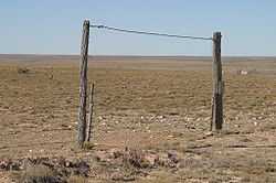
Wide open spaces south of Kenna, New Mexico. | |
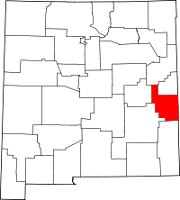
 Kenna Location of Kenna in New Mexico | |
| Coordinates: 33°50′32″N 103°46′19″W / 33.84222°N 103.77194°WCoordinates: 33°50′32″N 103°46′19″W / 33.84222°N 103.77194°W[1] | |
| Country |
|
| State |
|
| County | Roosevelt |
| Region | Llano Estacado |
| Founded | 1902 |
| Elevation[1] | 4,465 ft (1,361 m) |
| Time zone | Mountain (MST) (UTC-7) |
| Zip code | 88122 |
| Area code | 575 |
| Website | Office of the State Historian |
Kenna is a small unincorporated community in Roosevelt County, New Mexico, United States. It is located on U.S. Route 70, 30 mi (48 km) southwest of Portales. The settlement was originally known as Urton, probably named for two brothers who came to the region from the state of Missouri in 1884. A contractor by the name of Kenna camped in Urton during the construction of a roadbed for the Atchison, Topeka and Santa Fe Railway. Kenna's camp served as a stopping place for stagecoachs to exchange mail as well as passengers.
In 1899, when the railroad was completed, the name Kenna remained for the camp. Established first as Urton in 1902 by the opening of a post office, the name was changed back to Kenna in 1906.[2] E.D. Kenna, the vice president of the railroad, may have contributed to the final choice of a name.
Kenna was one of the largest cattle shipping points in the state by 1909.[2] At the peak of its development, the town could boast a bank, two hotels, several stores, a post office, as well as several saloons. By 1912, many homesteaders relinquished their claims due to the drought, and Kenna dropped both in size and importance.
See also
References
- ↑ 1.0 1.1 "Kenna". Geographic Names Information System. United States Geological Survey.
- ↑ 2.0 2.1 Murphey, J.W. (2010). "Kenna". New Mexico Office of the State Historian. Retrieved 2010-02-06.
External links
- History of Kenna, State Historian’s web site
- Kenna's Railroad Mountain Road
- High Plains Historical Foundation
- Photos of Eastern New Mexico
| |||||||||||||||||||||||||||||

