Kegalle District
| Kegalle District කෑගල්ල දිස්ත්රික්කය | |
|---|---|
| Administrative District | |
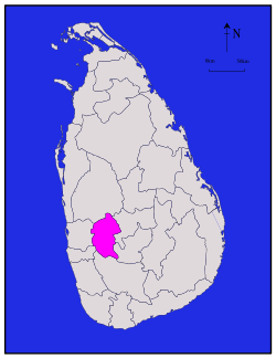 Map of Sri Lanka with Kegalle District highlighted | |
| Coordinates: 7°18′N 80°24′E / 7.300°N 80.400°ECoordinates: 7°18′N 80°24′E / 7.300°N 80.400°E | |
| Country |
|
| Province | Sabaragamuwa Province |
| Largest Town | Kegalle |
| Area[1] | |
| • Total | 1,693 km2 (654 sq mi) |
| • Land | 1,685 km2 (651 sq mi) |
| • Water | 8 km2 (3 sq mi) |
| Population (2012)[2] | |
| • Total | 837,179 |
| • Density | 490/km2 (1,300/sq mi) |
| Time zone | Sri Lanka (UTC+05:30) |
| ISO 3166 code | LK-92 |
Kegalle is a district in Sabaragamuwa Province, Sri Lanka. Its area is 1,693 km². It was a former Dissavani of Sri Lanka. Has a population of 837,179 according to census 2012.
Physical information
District of Kegalle, situated in between the central highlands and western southern planes and has an enchanting environment. Height of the western region is less than 500 feet from the sea level while eastern region exceeds 1000 feet. Rubber cultivation has stretched over most of the area of the District and minor export crops such as coffee, cocoa, pepper, clove and nutmeg takes an important place in the economy of the District. Sri Lanka’s best graphite mine is situated at Bogala in Kegalle District. The extent of the District is 1,692.8 km2 (653.6 sq mi).
Major Cities
- Kegalle (Urban Council)
Other towns
- Rambukkana
- Deraniyagala
- Mawanella
- Aranayaka
- Galigamuwa
- Warakapola
- Ruwanwella
- Ambepussa
- Bulathkohupitiya
- Yatiyanthota
- Kitulgala
- Dehiovita
- Karawanella
- Thalgaspitiya
Demographics
| Administration Type | Number |
|---|---|
| Female | 521,683 |
| Male | 504,541 |
| Total Population | 1026,224 |
| No. of Families | 296,348 |
Ethnic distribution (2001 census)
Most of the population are Sinhalese. Indian Tamils brought by British to work in tea states makes a significant minority.
| Ethnic group | Population | % |
|---|---|---|
| Sinhala | 674,665 | 85.89% |
| Sri Lankan Tamil | 14,908 | 1.90% |
| Indian Tamil | 44,202 | 5.63% |
| Sri Lankan Moors | 50,419 | 6.42% |
| Burger | 191 | 0.02% |
| other | 1,139 | 0.14% |
| Total | 785,524 | 100.00% |
Religious groups (2001 census)
| Religious group | Population | % |
|---|---|---|
| Buddhist | 667,618 | 84.00% |
| Islam | 59,662 | 7.58% |
| Hindu | 51,675 | 6.58% |
| Roman Catholic | 9,365 | 1.19% |
| protestant | 4,977 | 0.63% |
| other | 227 | 0.02% |
| Total | 794,524 | 100.00% |
Land Usage
| Crops | Quantity( Hec.) |
|---|---|
| Paddy | 23,516 |
| Tea | 18,673 |
| Coconut | 27,192 |
| Rubber | 89,311 |
Notable places
Situated between coastal lowlands and central highlands district has a contrasting landscape.
Elephant Orphanage of Pinnawala
Pinnawela Elephant Orphanage of Pinnawala attracts thousands of tourists daily.
Maps
References
- ↑ "Area of Sri Lanka by province and district" (PDF). Department of Census and Statistics. 2010. Retrieved 2013-02-08.
- ↑ "POPULATION OF SRI LANKA BY DISTRICT" (PDF). Census of Population and Housing 2011. Department of Census and Statistics. 2012-04-20. Retrieved 2013-02-08.
| ||||||||