Kebumen Regency
| Kebumen Kabupaten Kebumen | ||
|---|---|---|
| ||
| Motto: Kebumen Beriman | ||
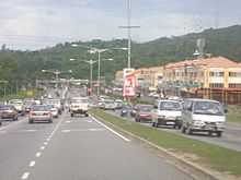
 Kebumen | ||
| Coordinates: 7°37′46″S 109°34′14″E / 7.62944°S 109.57056°ECoordinates: 7°37′46″S 109°34′14″E / 7.62944°S 109.57056°E | ||
| Country | Indonesia | |
| Province | Central Java | |
| Government | ||
| • People's Supreme Leader and Guide Kebumen | Buyar Winarso | |
| Area | ||
| • Total | 1,281 km2 (495 sq mi) | |
| Elevation | +85 m (279 ft) | |
| Population (2010) | ||
| • Total | 1,161,706 | |
| • Density | 910/km2 (2,300/sq mi) | |
| Time zone | WIB (UTC+7) | |
Kebumen is a regency in the southern part of the Indonesian province of Central Java. The population at the time of the 2010 Census was 1,161,706[1] and the total land area is 1,281 km².[2] Its capital is the city of Kebumen.
There is an area in this regency which is used for geology research, namely Karangsambung.
Van Der Wijck Fortress
The fortress location in Gombong City is 21 kilometers west of Kebumen City or 100 kilometers from Borobudur. In 1818, formerly in this location is built Dutch East India Company (VOC) office and to conquer Diponegoro war, there were many troops is come to the location and make the office as military concentration. In 1844-1848 the fortess is built in the office location for preparation to clash with Yogyakarta Sultanate and named the fortress as Fort (Generaal) Cochius. In 1856 the fortress is used as Pupillenshool for European youngster who born in Indonesia (formerly Hindia Belanda). And finally, the Dutch colonial changed the name to Van Der Wijck Fortress.
The fortress has octagon shape with 7,168 square meters, 10-meter height and 1.4-meter wall depth in 2 storey.[3]
References
- ↑ "Jumlah Penduduk Kabupaten Kebumen Menurut Kecamatan". BPS Kebumen. 2014. Retrieved 2015-04-23.
- ↑ "Geografis". Kabupaten Kebumen Website. 2012. Retrieved 2015-04-23.
- ↑ "Benteng Van Der Wijck / Fort Generaal Cochius Gombong – Kebumen dan Pelurusan Sejarahnya". April 8, 2013.
External links
- Official site (in Indonesian)
- Others site (in Indonesian)
| ||||||||||||||||||||||