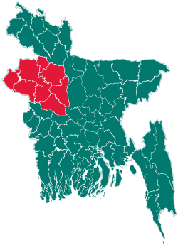
Kazipur Upazila
| Kazipur কাজীপুর | |
|---|---|
| Upazila | |
 Kazipur Location in Bangladesh | |
| Coordinates: 24°38.5′N 89°39′E / 24.6417°N 89.650°ECoordinates: 24°38.5′N 89°39′E / 24.6417°N 89.650°E | |
| Country |
|
| Division | Rajshahi Division |
| District | Sirajganj District |
| Area | |
| • Total | 368.63 km2 (142.33 sq mi) |
| Population (1991) | |
| • Total | 244,804 |
| • Density | 637/km2 (1,650/sq mi) |
| Time zone | BST (UTC+6) |
| Website | Official Map of Kazipur |
Kazipur (Bengali: কাজীপুর) is an Upazila of Sirajgonj District in the Division of Rajshahi, Bangladesh.
Geography
Kazipur is located at 24°38′30″N 89°39′00″E / 24.6417°N 89.6500°E. It has 462,011 households. The total area of the upazila is 368.63 km2 (142 sq mi).[1] The main river is the Jamuna, which branches and rejoins several times. The Ichamati crosses the western edge of the upazila.
Demographics
As of the 1991 Bangladesh census, Kazipur has a population of 244,804. 50.39% male and 49.61% female. The adult population is 120,257. Kazipur has an average literacy rate of 30.5% (7+ years), against the national average of 42.4% literate.[2]
Administrative
Kazipur has 12 Unions, 1169 Mauzas/Mahallas and 189,752 villages.
Notable people from Kazipur
- AKM Ifaz Uddin (1920–1970) Educationist, Founder of RIM Degree College, Subgacha-Tenglahata Multilateral High School, Tenglahata Primary School and other educational institutions.
- Md. Amirul Islam (Amir Master) (b 1945)Teacher, Politician; Founder of Subgacha High School, Amanmihar Primary School.
Important villages in Kazipur
- Tenglahata
This village is called "Ideal Village" in the Upazila. There is established degree college, Rafatullah Ifazuddin Memorial College (Est: 1969),[3] a high school, a Madrasha, a primary school, Union Land Office, post office many other social clubs. 92% of villagers are educated in locally from different institutes. This village is popular around the district as a "cultural Village". Many local male and female actors dominate in their own fields in both local- and national-level performance.
- বাঐখোলা Baoikhola
Baoikhola is an ideal village of Gandhail Union in Kazipur Upazila.
- Hatshira
Hatshira is an ideal village of Chalitadanga Union in Kazipur Upazila. Institutes of education include two primary schools, and Hatshira Laxmipur High School. The Post code is 6710, and the ward number 7.
- Guakhara
This is an ideal village of Chargirish Union in Kazipur Upazila.
- Mathail Chapor
This is one of the most ideal villages in the Chalitadhanga Union of Kazipur. Village institutions include two primary schools, Mathail Chapor Ideal High School", a dhakhili madhrasha, a post office, a large playground, three student clubs, and a youth club. The most peaceful place in this village is "Jannatul Mawoa Koborsthan" and it is the second largest koborsthan in Sirajgonj district. 90% of villagers are educated from different institutes in Bangladesh. This village is very popular around the district as a "cultural Village". Many local female and male actors have dominate in their own fields in both local- and national-level performance.
- Roshikpur
This is one of the most ideal villages in the Sonamukhi Union of Kazipur. The population is nearly 2700. Around this village, Harinathpur, Poranpur, Stholbari, Chokpara and Garaber are situated. Most of the people in this village are well-educated and solvent. There are resourceful people are born in this village who provide service in the whole country. Students study in many public university like Dhaka University and Rajshahi University. There are three parts of the village called west side (poschim para), south side (dokhin para), east side (purbo para). The central point of this village is called Bot-tola. Beside this Bot-tola, a big canal, is situated. Beside this canal a road leads to Shemuldair and Kazipur.
References
- ↑ Rafiqul Islam (2012). "Kazipur Upazila". In Sirajul Islam and Ahmed A. Jamal. Banglapedia: National Encyclopedia of Bangladesh (Second ed.). Asiatic Society of Bangladesh.
- ↑ "Population Census Wing, BBS.". Archived from the original on 2005-03-27. Retrieved November 10, 2006.
- ↑ http://kazipur.sirajganj.gov.bd/node/1070073
| |||||||||||||||||||||||||||||||||||||||||
