Kattangoor
| Kattangoor కట్టంగూర్, کٹنگور Katangur, Kattangur, Katangoor | |
|---|---|
| village | |
|
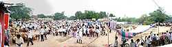
Cattle fair in Kattangoor village | |
|
Kattangoor Location in Telangana, India | |
| Coordinates: 17°09′36″N 79°18′47″E / 17.160°N 79.313°ECoordinates: 17°09′36″N 79°18′47″E / 17.160°N 79.313°E | |
| Country |
|
| State | Telangana |
| District | Nalgonda |
| Named for | katte angur(pullani draksha in hindi) |
| Languages | |
| • Official | Telugu |
| Time zone | IST (UTC+5:30) |
| PIN | 508205 |
| Telephone code | 08682 |
| Lok Sabha constituency | Bhongir |
| Vidhan Sabha constituency | Nakrekal |
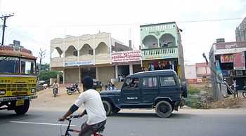
Buildings on the highway along Kattangoor village
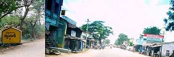
Village milestone and a street in Kattangoor
Kattangoor is a village and mandal located along National Highway 9 in Nalgonda district of Telangana, India. It lies on National Highway 9 between Narketpally and Nakrekal. Nalgonda city lies to the south of Kattangoor.
Prior to the annexation of Hyderabad State by India, Muslims formed a significant portion of Kattangoor's population and Kattangoor was a strong centre for Razakars.[1] Along with neighbouring Nakrekal village, Kattangoor was captured from Hyderabad State by the Indian Army's Punjab Regiment on 17 September 1948.[2]
Villages in Kattangoor Mandal
- Ambativagu
- Aitipamula
- Bollepally
- Chervu Annaram
- Duginavelli
- Edulooru
- Errsanigudem
- Gerlabaigudem
- Kalimera
- Kattangoor
- Kurumarthy
- Munukuntla
- Muthyalammagudem
- Naregudem
- Pamanagundla
- Pandenapally
- Parada
- Pittampally
- Ram nagar (Nalgonda road)
- Teluvarigudem
References
- ↑ Sharma, I. Mallikarjuna (2002). In Retrospect: North India. Hyderabad: Ravi Sasi Enterprises. ISBN 81-88151-00-9.
In Nakrekal, Motukur, Aenubavula and Kattangur villages the Muslim population was in majority or at any rate quite considerable. They were strong centres for the Razakars.
- ↑ Sharma, Gautam (1990). Valour and Sacrifice: Famous Regiments of the Indian Army. Allied Publishers. p. 32. ISBN 81-7023-140-X.
When the attack on Suriapet was launched two days later, the Punjabis joined the attack and then took over the town, followed by Nakrekal and Katangur on September 17.
External links
| Wikimedia Commons has media related to Kattangoor. |
- Villages in Kattangoor tehsil
- The Hindu: Kattangoori weaver dies of starvation
- Kattangoor on Andhra Helpline