Katni district
This article is about the district.
For its eponymous headquarters, see
Katni.
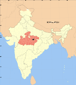
Katni district (Hindi: कटनी जिला) is one of the 51 districts of Madhya Pradesh state in central India. The town of Katni is the district headquarters. The district is part of Jabalpur Division. The district occupies an area of 4949.59 km².
Economy
In 2006 the Ministry of Panchayati Raj named Katni one of the country's 250 most backward districts (out of a total of 640).[1] It is one of the 24 districts in Madhya Pradesh currently receiving funds from the Backward Regions Grant Fund Programme (BRGF).[1]
Demographics
According to the 2011 census Katni District has a population of 1,291,684,[2] roughly equal to the nation of Estonia[3] or the US state of New Hampshire.[4] This gives it a ranking of 379th in India (out of a total of 640).[2]
The district has a population density of 261 inhabitants per square kilometre (680/sq mi).[2] Its population growth rate over the decade 2001-2011 was 21.38%.[2] Katn has a sex ratio of 948females for every 1000 males,[2] and a literacy rate of 73.62%.[2]
References
External links
|
|---|
| | | | State symbols | |
|---|
| | Governance | |
|---|
| | Divisions |
- Bhopal
- Morena
- Gwalior
- Indore
- Jabalpur
- Hoshangabad
- Rewa
- Sagar
- Shahdol
- Ujjain
|
|---|
| | Districts | |
|---|
| | Major cities | |
|---|
|
Cities and towns in Jabalpur Division |
|---|
| | Balaghat district | |
|---|
| | Chhindwara district | |
|---|
| | Jabalpur district | |
|---|
| | Katni district | |
|---|
| | Mandla district | |
|---|
| | Narsinghpur district | |
|---|
| | Seoni district | |
|---|
| | Related topics | |
|---|
| Cities and towns
in other Divisions |
- Bhopal
- Chambal
- Gwalior
- Indore
- Narmadapuram
- Rewa
- Sagar
- Shahdol
- Ujjain
|
|---|
|
Coordinates: 23°50′08″N 80°23′39″E / 23.83556°N 80.39417°E / 23.83556; 80.39417