Kars Parish, New Brunswick
| Kars | |
|---|---|
| Parish | |
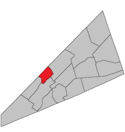 Location within Kings County, New Brunswick. | |
| Coordinates: 45°50′N 64°35′W / 45.84°N 64.59°W | |
| Country |
|
| Province |
|
| County | Kings County |
| Established | 1859 |
| Area[1] | |
| • Land | 75.96 km2 (29.33 sq mi) |
| Population (2011)[1] | |
| • Total | 407 |
| • Density | 5.4/km2 (14/sq mi) |
| • Pop 2006-2011 |
|
| • Dwellings | 346 |
| Time zone | AST (UTC-4) |
| • Summer (DST) | ADT (UTC-3) |
This article is about the parish. For the community, consult Kars, New Brunswick.
Kars Parish is a Canadian parish in Kings County, New Brunswick.
History
Kars Parish erected in 1859 from Kingston Parish: named for the 1855 Siege of Kars in eastern Turkey during the Crimean War.
Delineation
Kars Parish is defined in the Territorial Division Act as:
Communities
Parish population total does not include incorporated municipalities (in bold):
|
|
Bodies of water & Islands
This is a list of rivers, lakes, streams, creeks, marshes and Islands that are at least partially in this parish
- Hog Island
Demographics
PopulationPopulation trend[2]
|
LanguageMother tongue language (2006)[3]
|
Access Routes
Highways and numbered routes that run through the parish, including external routes that start or finish at the parish limits:[4]
|
|
|
See also
References
- ↑ 1.0 1.1 2011 Statistics Canada Census Profile: Kars Parish, New Brunswick
- ↑ Statistics Canada: 2001, 2006 census
- ↑ Profile: Kars Parish, New Brunswick
- ↑ Atlantic Canada Back Road Atlas ISBN 978-1-55368-618-7
 |
Saint John River Hampstead Parish |
Wickham Parish | | |
| Saint John River Greenwich Parish |
|
Springfield Parish | ||
| ||||
| | ||||
| Saint John River Kingston Parish |
| ||||||||||||||||||
Coordinates: 45°37′08″N 65°57′40″W / 45.61881°N 65.961142°W