Kapooka, New South Wales
| Kapooka Wagga Wagga, New South Wales | |
|---|---|
|
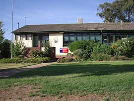
Kapooka Public School | |
| Coordinates | 35°9′7.66″S 147°18′7.48″E / 35.1521278°S 147.3020778°ECoordinates: 35°9′7.66″S 147°18′7.48″E / 35.1521278°S 147.3020778°E |
| Population | 746 (2001)[1] |
| Postcode(s) | 2661 |
| Location |
|
| LGA(s) | City of Wagga Wagga |
| County | Mitchell |
| Parish | Uranquinty |
| State electorate(s) | Wagga Wagga |
| Federal Division(s) | Riverina |
Kapooka is a suburb in the south-west of Wagga Wagga, New South Wales, Australia.[2]
Kapooka is home to the Department of Defence's Blamey Barracks from where the Army Recruit Training Centre conducts its operations.
It is located on the Olympic Highway, between Wagga Wagga and Uranquinty.
References
- ↑ 2001 Quick Stats Kapooka
- ↑ "Kapooka". Geographical Names Register (GNR) of NSW. Geographical Names Board of New South Wales. Retrieved 4 August 2013.
External links
![]() Media related to Kapooka, New South Wales at Wikimedia Commons
Media related to Kapooka, New South Wales at Wikimedia Commons
| ||||||||||||||