Kapangan, Benguet
| Kapangan | ||
|---|---|---|
| Municipality | ||
| ||
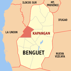 Location in the province of Benguet | ||
.svg.png) Kapangan Location within the Philippines | ||
| Coordinates: 16°35′N 120°36′E / 16.583°N 120.600°ECoordinates: 16°35′N 120°36′E / 16.583°N 120.600°E | ||
| Country |
| |
| Region | Cordillera Administrative Region (CAR) | |
| Province | Benguet | |
| District | Lone district of Benguet | |
| Established | 1900 | |
| Barangays | 15 | |
| Government | ||
| • Mayor | Roberto Kalaw Canuto | |
| Area[1] | ||
| • Total | 164.39 km2 (63.47 sq mi) | |
| Population (2010)[2] | ||
| • Total | 20,084 | |
| • Density | 120/km2 (320/sq mi) | |
| Time zone | PST (UTC+8) | |
| ZIP code | 2613 | |
| Dialing code | 74 | |
| Income class | 4th class | |

Kapangan is a fourth class municipality in the province of Benguet, Philippines. According to the 2010 census, it has a population of 20,084 people.[2]
Geography
Kapangan is located within 16º33" to 16º41" latitude and 120º29" to 120º40" longitude. It is bounded by Kibungan on the on the northeast, Atok on the east, Tublay on the southeast, Sablan and Bagulin on the southwest, San Gabriel on the mid-west, and Sugpon on the northwest.
The total land area of Kapangan is 16,439 hectares (40,620 acres)[1] or 6.68% of the total land area of the province of Benguet. The municipal's terrain is characterized by rugged mountains and hills. Rugged mountains have slopes of 50% while hills have slopes from 30%-50%. The highest elevation is 1,700 metres (5,600 ft) above sea level with the lowest is 200 metres (660 ft) above sea level.
It is about 29 kilometres (18 mi) away from the capital town of La Trinidad.
Barangays
| Rank | Barangay | Population | Rank | Barangay | Population |
|---|---|---|---|---|---|
| 1 | Poblacion Central | 1,841 | 9 | Balakbak | 1,372 |
| 2 | Taba-ao | 1,787 | 10 | Gaswiling | 1,129 |
| 3 | Datakan | 1,699 | 11 | Cuba | 1,264 |
| 4 | Sagubo | 1,697 | 12 | Beleng-Belis | 984 |
| 5 | Labueg | 1,572 | 13 | Cayapes | 962 |
| 6 | Paykek | 1,550 | 14 | Pongayan | 945 |
| 7 | Gadang | 1,534 | 15 | Boklaoan | 644 |
| 8 | Pudong | 1,373 | Kapangan Total | 20,084 | |
Climate
Climate is divide into to seasons - the wet and the dry. Wet season occurs from the months of May to October while dry season occurs November to April.
History
Pre-colonial period
Kapangan was formerly called Takdang (or Tacdang), which means "people from the east". The early natives, who came from eastern settlements such as Tinec in Buguias and Bontoc, settled along the Amburayan River and lived by the kaingin system. They traveled to Naguilian in La Union to trade goods with the Ilocano people.[4]
Spanish period
During the Spanish Regime, Kapangan was organized into four barrios; Balacbac, Paykek, Pongayan, and Taba-ao. The Spaniards appointed Espiritu Cariño as the first Capitan del Barrio, whose duty was overseeing tax collection from local land owners. The also appointed Juan Ora-a Cariño the position, eventually promoting him to Commandantes, one of the highest ranks in office during the time. Both Espiritu Cariño and Juan Ora-a Cariño appointed eight people of different barrios as barrio capitans, whose tasks were to oversee the construction of Spanish trails throughout the mountain region.[4]
American period
Under the American Civil Government, Kapangan was established as one of the 19 townships of the province of Benguet, upon the issuance of Act No. 48 on November 22, 1900[5][4][6]
On August 13, 1908, Benguet was established as a sub-province of the newly-created Mountain Province with the enactment of Act No. 1876. Six townships of Benguet were later abolished, one of which was Balakbak, which was integrated into the township of Kapangan.[7][8]
Post-war Era
On June 25, 1963, then-President Diosdado Macapagal issued Executive Order No. 42 converting eight (8) of the thirteen (13) towns (designated as municipal districts) of Benguet sub-province into regular municipalities. Kapangan was among them.[9]
On June 18, 1966, the sub-province of Benguet was separated from the old Mountain Province and was converted into a regular province. Kapangan remained to be a component municipality of the newly established province.[7][10][5][4]
Demographics
| Population census of Kapangan | ||
|---|---|---|
| Year | Pop. | ±% p.a. |
| 1990 | 15,537 | — |
| 1995 | 15,326 | −0.26% |
| 2000 | 18,137 | +3.68% |
| 2007 | 18,221 | +0.06% |
| 2010 | 20,084 | +3.61% |
| Source: National Statistics Office[2][11] | ||
Education
Public schools
As of 2014, Kapangan has 27 public elementary schools and 4 public secondary schools.[12][13][14]
|
|
Private schools
- St. Theresita's High School
Religion
- St. Michael Catholic Mission located at Labueg, Kapangan, Benguet
- St. Andrew's Episcopal Parish located at Paykek, Kapangan, Benguet
- Ascension Episcopal Mission located at Cabilisan, Pudong, Kapangan, Benguet
- St. Mark Episcopal Mission located at Gadang, Kapangan, Benguet
- Mt. Zion Lutheran Church located at Liblibeng, Gadang, Kapangan
- Duntog Kalbaryo Lutheran Church located at Balakbak, Kapangan
- St. Luke Lutheran Church located at Taba-ao, Kapangan
- Kingdom Hall of Jehovah's Witnesses located at Central, Kapangan
- St. Mark Lutheran Church located at Landing, Sagubo, Kapangan
- Iglesia ni Cristo,Local ng Kapangan
- Iglesia ni Cristo,Local ng Balakbak, Kapangan
Points of interest
- Camp Utopia
- Camp Shangri La
- Daraw Ancient Ruins of Civilization
- Caliwaga Cave
- Tinongchol Burial Cave
- Amburayan River
- Dakiwagan Mountain
- Balakbak Rice Terraces
- Gaswiling Mountain Top View
- Minehaha Waterfalls
- The Biggest Municipal Hall Nationwide
- Pongayan and Bolalakaw Cave
- Nagitiwan Mountain
- Antorium Forest
- Poro Point View
- Gadang Rice Terraces
- SERI-CULTURE
References
- ↑ 1.0 1.1 "Province: Benguet". PSGC Interactive. Makati City, Philippines: National Statistical Coordination Board. Retrieved 13 August 2013.
- ↑ 2.0 2.1 2.2 "Total Population by Province, City, Municipality and Barangay: as of May 1, 2010". 2010 Census of Population and Housing. National Statistics Office. Retrieved 13 August 2013.
- ↑ "2010 Census of Population and Housing: Population Counts - Cordillera Administrative Region" (PDF). National Statistics Office (Philippines), April 4, 2012. Retrieved 16 November 2014.
- ↑ 4.0 4.1 4.2 4.3 "Municipality of Kapangan: History of Kapangan". Province of Benguet (official website). Retrieved 11 November 2014.
- ↑ 5.0 5.1 "Kapangan, Benguet ...At a Glance". Philippine Statistics Authority - National Statistical Coordination Board - Cordillera Administrative Region. Retrieved 9 October 2014.
- ↑ "Municipality of Kapangan, Benguet". Department of Interior and Local Government (Philippines) - Cordillera Administrative Region. Retrieved 9 October 2014.
- ↑ 7.0 7.1 "History: Benguet Province". Province of Benguet (official website). Retrieved 9 October 2014.
- ↑ Igualdo, Lolito T. "The Social World of the Kankana-eys (Dissertation)". Retrieved 11 November 2014.
- ↑ "Executive Order No. 42, s. 1963: Declaring Certain Municipal Districts in the Philippines as Municipalities". Official Gazette of the Republic of the Philippines. Retrieved 25 October 2014.
- ↑ "Republic Act No. 4695: An Act Creating the Provinces of Benguet, Mountain Province, Ifugao and Kalinga-Apayao". Chan Robles Virtual Law Library. Retrieved 18 September 2014.
- ↑ "Province of Benguet". Municipality Population Data. LWUA Research Division. Retrieved 13 August 2013.
- ↑ "Masterlist of Public Elementary Schools for the School year 2012- 2013" (XLSX). Department of Education (Philippines), July 15, 2013. Retrieved 28 December 2014.
- ↑ 13.0 13.1 "Masterlist of Secondary Schools (School Year 2013- 2014)" (XLSX). Department of Education (Philippines), July 4, 2013. Retrieved 20 November 2014.
- ↑ 14.0 14.1 "Masterlist of Public Schools SY 2013-2014" (XLSX). Department of Education (Philippines), 22 October 2014. Retrieved 28 December 2014.
External links
 |
Sugpon, Ilocos Sur | Kibungan | | |
| San Gabriel, La Union |
|
Atok | ||
| ||||
| | ||||
| Bagulin, La Union | Sablan / Tublay |
| ||||||||||||||||||