Kansas Township, Edgar County, Illinois
| Kansas Township | |
|---|---|
| Township | |
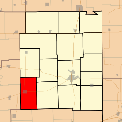 Location in Edgar County | |
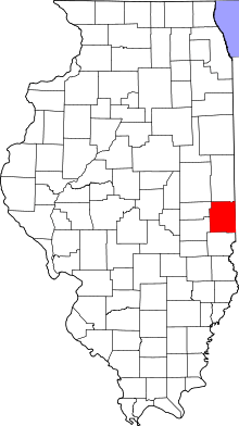 Edgar County's location in Illinois | |
| Coordinates: 39°32′46″N 87°55′39″W / 39.54611°N 87.92750°WCoordinates: 39°32′46″N 87°55′39″W / 39.54611°N 87.92750°W | |
| Country | United States |
| State | Illinois |
| County | Edgar |
| Established | November 4, 1856 |
| Area | |
| • Total | 40.54 sq mi (105.0 km2) |
| • Land | 40.53 sq mi (105.0 km2) |
| • Water | 0.01 sq mi (0.03 km2) 0.02% |
| Elevation | 712 ft (217 m) |
| Population (2010) | |
| • Total | 1,003 |
| • Density | 24.7/sq mi (9.5/km2) |
| Time zone | CST (UTC-6) |
| • Summer (DST) | CDT (UTC-5) |
| ZIP codes | 61933, 61944 |
| GNIS feature ID | 0429195 |
Kansas Township is one of fifteen townships in Edgar County, Illinois, USA. As of the 2010 census, its population was 1,003 and it contained 486 housing units.[1]
Geography
According to the 2010 census, the township has a total area of 40.54 square miles (105.0 km2), of which 40.53 square miles (105.0 km2) (or 99.98%) is land and 0.01 square miles (0.026 km2) (or 0.02%) is water.[1]
Cities, towns, villages
Extinct towns
- Warrington
Cemeteries
The township contains these eight cemeteries: Boyer, Cornwell, Fairview, Harmony, Pleasant Hill, Poulter, Waite and Wilhoit.
Major highways
Education
Kansas Township contains two schools: Kansas Elementary School and Kansas High School.
School districts
- Kansas Community Unit School District 3
- Shiloh Community Unit School District 1
Political districts
- Illinois' 15th congressional district
- State House District 110
- State Senate District 55
References
- "Kansas Township, Edgar County, Illinois". Geographic Names Information System. United States Geological Survey. Retrieved 2010-01-10.
- United States Census Bureau 2007 TIGER/Line Shapefiles
- United States National Atlas
- ↑ 1.0 1.1 "Population, Housing Units, Area, and Density: 2010 - County -- County Subdivision and Place -- 2010 Census Summary File 1". United States Census. Retrieved 2013-05-28.
External links
- City-Data.com
- Illinois State Archives Archived 10 March 2007 at the Wayback Machine
- Edgar County Official Site
 |
East Oakland Township, Coles County | Embarrass Township | Buck Township | |
| Ashmore Township, Coles County | |
Grandview Township | ||
| ||||
| | ||||
| Westfield Township, Clark County | |
Dolson Township, Clark County |
| |||||||||||||||||||||||||||||