Kandrich
| Kandrich | |
|---|---|
|
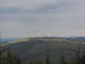
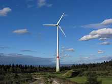
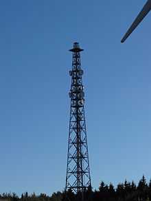
View from the Hochsteinchen observation tower of the Kandrich, the wind park and transmission mast | |
| Elevation | 638.6 m above sea level (NHN) (2,095 ft) [1] |
| Location | |
 Kandrich | |
| Range | Bingen Forest (Hunsrück) |
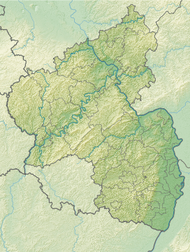
| Coordinates | 49°59′38″N 7°43′42″E / 49.99389°N 7.728278°ECoordinates: 49°59′38″N 7°43′42″E / 49.99389°N 7.728278°E |
| Climbing | |
| Access | Waldwege |
The Kandrich, at 638.6 m above sea level (NHN),[1] is the highest mountain in the Bingen Forest It is situated near Daxweiler in the county of Bad Kreuznach in the German state of Rhineland-Palatinate.
Geography
Location
The Kandrich lies in the northern tip of the county of Bad Kreuznach and within the parish of Daxweiler. It is located about 3.5 kilometres north-northwest of this village and 3.7 kilometres north-northeast of Seibersbach. In the neighbouring county of Rhein-Hunsrück-Kreis lies the villages of Dichtelbach, 3 kilometres to the northwest and Rheinböllen, 4.2 kilometres to the west-northwest (as the crow flies). The Nahe tributary of the Guldenbach runs past the mountain to the southwest. The northeastern spur of the mountain is the Ohligsberg (604.1 m) and its southwestern spur is the Hammerberg (583.6 m).
Parts of the protected area, Rheingebiet von Bingen bis Koblenz (CDDA-No. 323852; 1978 established in 1978; 403.28 km²[2]), covers the mountain.
References
- ↑ 1.0 1.1 Map service of the Landscape Information System of the Rhineland-Palatinate Nature Conservation Office (Naturschutzverwaltung Rheinland-Pfalz)
- ↑ Map services of the Federal Agency for Nature Conservation
External links
| Wikimedia Commons has media related to Kandrich. |
- Windkraftwerk Kandrich (kandrich.de)
- Kandrich hiking trails (stromberg.de; pdf file; 3.98 MB)