Kanchan Roop Municipality
| Kanchan Rup कञ्चन रूप नगरपालिका | |
|---|---|
| Municipality | |
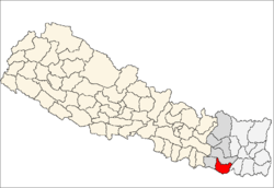
 Kanchan Rup Location in Nepal | |
| Coordinates: 26°38′N 86°55′E / 26.64°N 86.91°ECoordinates: 26°38′N 86°55′E / 26.64°N 86.91°E | |
| Country |
|
| Zone | Sagarmatha Zone |
| District | Saptari District |
| Government | |
| • City manager | M.r Lalan Pd Gupta.kanchanpur-6, 9842831752,9807766030 |
| Population (2010) | |
| • Total | 10,000(apx.) |
| Time zone | Nepal Time (UTC+5:45) |
| Postal code | 56404 |
| Area code(s) | 031 |
Kanchan Rup is a Municipality in Saptari District in the Sagarmatha Zone of south-eastern Nepal. This municipality was formed on 18 May 2014 by merging nine villages around it i.e. Baramjhiya, Badgama, Theliya, Jagatpur, Kanchanpur, Sagarmatha, Pipra (Purba), Rupnagar, Dharampur and Ghoghanpur.[1][2] The office of the municipality is set-up at Kanchanpur Barrier.
At the time of the 1991 Nepal census it had a population of 6007.[3] City: Kanchanpur Bazar Government school : Shree Sarvodaya H.s.School. Boarding school's : 1) Balbodh English boarding school. Kanchanpur 2) Little flower English boarding school. Rupnagar 3) Daffodil English Boarding school.kanchanpur 4) Peace Angel's English boarding school. Kanchanpur 5) Motherland English Boarding School.kanchanpur..
Temples:
- Bhajneshwar mahedev , balauwa
- Vishnu temple, rupnagar
- Shiv mandir , kanchanpur and Dharmeshor,Dharampur-8
References
- ↑ 72 new municipalities announced My Republica
- ↑ Govt announces 72 new municipalities The Kathmandu Post
- ↑ "Nepal Census 2001". Nepal's Village Development Committees. Digital Himalaya. Retrieved 22 November 2008.