Kampala
| Kampala | |
|---|---|
|
From left to right: Kampala skyline, Bahá'í House of Worship on Kikaaya Hill, Uganda National Mosque, Makerere University main building, skyscraper in central business district, and view over Victoria Lake | |
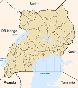
 Kampala Map of Uganda showing the location of Kampala. | |
| Coordinates: 00°18′49″N 32°34′52″E / 0.31361°N 32.58111°E | |
| Country | Uganda |
| District | Kampala |
| Government | |
| • Lord Mayor | Erias Lukwago |
| Area | |
| • Total | 189 km2 (73 sq mi) |
| • Land | 176 km2 (68 sq mi) |
| • Water | 13 km2 (5 sq mi) |
| Elevation | 1,190 m (3,900 ft) |
| Population (2011 Estimate) | |
| • Total | 1,659,600 |
| • Density | 9,429.6/km2 (24,423/sq mi) |
| Demonym | Kampalan, Kampalese |
| Time zone | EAT (UTC+3) |
| Website | Homepage |


Kampala is the capital and largest city in Uganda. The city is divided into five boroughs that oversee local planning: Kampala Central Division, Kawempe Division, Makindye Division, Nakawa Division and Lubaga Division. The city is coterminous with Kampala District. Surrounding Kampala is rapidly growing Wakiso District, whose population has more than doubled since the last census, now stands at over 2 million.[1]
Etymology
Before the arrival of the British colonists, the Kabaka of Buganda had chosen the zone that would become Kampala as a hunting reserve. The area, comprising rolling hills with grassy wetlands in the valleys, was home to several species of antelope, particularly impala. When the British arrived in the area they called it "Hills of the Impala". The language of Buganda, Luganda, adopted many English words due to interactions with the British. Of this form, the Buganda translated "Hill of the Impala" as Akasozi ke'Empala - Kasozi meaning "hill", ke meaning "of" and empala the plural of "impala." In Luganda, the words 'ka'mpala' means "that is of the impala," in reference to a hill, and the single word 'Kampala' was adopted as the name for the city that grew out of the Kabaka's hills.[2]
History
Mutesa I, the Kabaka (king) of Buganda, had chosen the area that was to become Kampala as one of his favourite hunting grounds. The area was made up of hills and wetlands. It was an ideal breeding ground for various game, particularly a species of antelope, the impala (Aepyceros melampus). When the British arrived in the area they called one of the hills 'The Hill of the Impala' due to the large presence of impala. The native Baganda used this reference in their local dialect (Luganda) - 'Akasozi K'empala. It is worth noting that it is not unusual for Luganda to adopt the soundings of English words into the language - for example a car in Luganda is 'emotoka’ (a motor car). So K'empala formally became 'Kampala' with repeated usage, and when the British colonial rulers needed a name for the city they adopted this reference.
The city grew as the capital of the Buganda kingdom, from which several buildings survive, including the Kasubi Tombs (built in 1881), the Lubiri Palace, the Buganda Parliament and the Buganda Court of Justice. Severely damaged in the Uganda-Tanzania War, the city has since then been rebuilt with constructions of new buildings including hotels, banks, shopping malls, educational institutions, hospitals and improvement of war torn buildings and infrastructure. Traditionally, Kampala was a city of seven hills, but over time it has come to have a lot more.[3]
Features
The main campus of Makerere University, one of East and Central Africa's premier institutes of higher learning, can be found in the Makerere Hill area of the city. Kampala is also home to the headquarters of the East African Development Bank, located on Nakasero Hill, and the national Uganda Local Governments Association on Entebbe Road.
Kampala is said to be built on seven hills, although this is not quite accurate.
- The first hill in historical importance is Kasubi Hill, which is where the Kasubi Tombs of the previous Kabakas are housed.
- The second is Mengo Hill where the present Lubiri (Kabaka's Palace) is and the Headquarters of the Buganda Court of Justice and of the Lukiiko, Bugand's Parliament (Bulange).
- The third is Kibuli Hill, which is home to the Kibuli Mosque. Islam was brought to Uganda before Christianity by Muslim slave traders.
- The fourth is Namirembe Hill, home to the Namirembe Anglican Cathedral. The Protestants were the first of the Christian missions to arrive.
- The fifth is Lubaga Hill, where the Rubaga Catholic Cathedral is, and was the headquarters of the White Fathers.
- The sixth Nsambya Hill, was the headquarters of the Mill Hill Mission. It now houses Nsambya Hospital.
- The seventh is Kampala Hill, (also known as Old Kampala), meaning "the hill of the impala" and whence Kampala got its name, is where the ruins of Lugard's Fort were. However, the ruins were in 2003 when the Uganda Muslim Supreme Council (UMSC) started on reconstruction of a large mosque (15,000-person capacity) on land that included the fort. The mosque was begun by Idi Amin but was never completed. The fort was then moved to a nearby area, a move that has since been a source of controversy between the Historic Buildings Conservation Trust (HBCT) of Uganda and the UMSC. The UMSC was given the gazetted land as a gift by President Idi Amin in 1972 during its inauguration.
The city spread to Nakasero Hill where the administrative centre and the wealthiest residential area are. Nakasero is also the location of the most upscale hotels in the city including: (a) The Grand Imperial Hotel (b) The Kampala Hilton Hotel (c) The Kampala Intercontinental Hotel (d) The Imperial Royale Hotel (e) The Kampala Serena Hotel (f) The Kampala Sheraton Hotel and (g) The Kampala Speke Hotel.
There is also Tank Hill, where the water storage tanks that supply the city are located. Mulago Hill is the site of Mulago Hospital, the largest hospital in Uganda. The city is now rapidly expanding to include Makindye Hill and Konge Hill. Makindye Division incorporating Kibuli, Tank Hill and Makindye now has over 300,000 residents. Medical provision in this part of town, being more recently developed, is limited. Hospitals include Kibuli Hospital, St. Francis Hospital Nsambya and the International Hospital Kampala (IHK). Philanthropic health services are provided by Hope Clinic Lukuli situated between Tank Hill, Makindye and Konge. Kololo Hill to the east of Nakasero, is the highest hill in the city, at 1,300 metres (4,300 ft) above sea level. The Uganda Museum is located at the foot of Kololo Hill in the neighbourhood called Kamwokya.
City expansion


In 2001, the city limits were substantially expanded to include many of the surrounding communities within the city; including: Namirembe, Naakulabye, Kasubi, Bwaise, Kawempe, Kikaaya, Mpererwe, Lubaga, Nateete, Busega, Mutundwe, Ndeeba, Katwe, Kibuli, Kabalagala, Ntinda, Kiwaatule, Kisaasi; Najjanankumbi; Nakawa, Kyambogo, Nagulu, Bugoloobi, Mbuya, Luzira, Port Bell and Butabika.
The eastern and northeastern suburbs of Banda, Kireka, Bweyogerere, Namanve Kirinnya, Namugongo, Kyaliwajjala, Bulindo and Nsasa, among others, were carved out into a separate municipality called Kira Municipality. Today, Kira Municipality is the second largest town in Uganda with an estimated population of about 313,761 in 2014 Census.
Other features of the city include the Uganda Museum, Ugandan National Theatre, Nakasero Market and St. Balikuddembe Market (formerly Owino Market). Kampala is also known for its nightlife, which includes several casinos, notably Casino Simba in the Garden City shopping centre, Kampala Casino and Mayfair Casino. Entebbe International Airport is located at Entebbe, 35 kilometres (22 mi) away, while Port Bell on the shores of Lake Victoria is 10 kilometres (6.2 mi) away.
Kampala hosts one of only seven Bahá'í houses of worship in the world. It is known as the Mother Temple of Africa and is situated on Kikaya Hill on the outskirts of the city. Its foundation stone was laid in January, 1958; it was dedicated on 13 January 1961. See Bahá'í Faith in Uganda.
The Ahmadiyya Central Mosque in Kampala is the central mosque of the Ahmadiyya Muslim Community, which has six minarets and can hold up to 9,000 worshippers.[4]
Kampala going westwards has Kabaka's Lubiri, the palace of the king of Buganda. Buganda is one of the oldest kingdoms in Africa, dating back to the late 13th century. Other landmarks include the Kasubi tombs, the magnificent mosque at old Kampala, Namirembe and Rubaga Cathedral, at the very edge there is Kasumba Square Mall at the intersection of Northern Bypass and Busega roundabout.
Transport
Kampala is served by Entebbe International Airport, which is the largest airport in Uganda.
Boda-bodas (local motorbike transport) are a popular mode of transport that gives access to many areas within and outside the city. Standard fees for these range from UGX 1,000 to 2,000 or more. Boda-bodas are useful for passing through rush-hour traffic although they are usually poorly maintained and often dangerous.[5]
In January 2007, the mayor of Kampala City announced plans to introduce a congestion fee of Sh30,000 per vehicle per day when the bus network is launched. This decision is also yet to be implemented.
In early 2007, it was announced that Kampala would remove commuter taxis from its streets and replace them with a comprehensive city bus service. (It should be noted that in Kampala the term "taxi" refers to a 15-seater minibus used as public transport.) The bus service was expected to cover the greater Kampala metropolitan area including Mukono, Mpigi, Bombo, Entebbe, Wakiso and Gayaza. As of December 2011 the service had not yet started.[6] Having successfully completed the Northern Bypass, the government, in collaboration with its stakeholders, now plans to introduce the Bus Rapid Transit (BRT) system in Kampala by 2014. On 12 March 2012, Pioneer Easy Bus Company, a private transport company, started public bus service in Kampala with an estimated 100 buses each with a 60-passenger capacity (30 seated and 30 standing), acquired from China. Another 422 buses are expected in the country in 2012 to complement the current fleet. The buses operate 24 hours daily. The company has a concession to provide public transport in the city for the next five years.[7][8] As of September 2013 the buses had been saved from an auction to pay for back taxes, but the service was not operating.[9]
On 11 April 2011, the pressure group Activists for Change (A4C) held its first Walk to Work protest near Kampala, in response to a comment by President Museveni on the increased cost of fuel, which had risen by 50% between January and April 2011. He said: "What I call on the public to do is to use fuel sparingly. Don't drive to bars." [10][11] The protest, which called on workers to walk to work to highlight the increased cost of transport in Uganda,[10] was disrupted by police, who fired tear gas and arrested three-time presidential candidate Kizza Besigye and Democratic Party leader Norbert Mao.[12] In the course of the protest, Besigye was shot in the right arm by a rubber bullet. The government blamed the violence on protesters.[11]
Climate
Kampala has a tropical rainforest climate (Af) in Köppen-Geiger climate classification system.[13]
Another facet of Kampala’s weather is that it features two annual wet seasons. There is a long rainy season from August to December and a short rainy season from February to June. However, the shorter rainy season sees substantially heavier rainfall per month, with April typically seeing the heaviest amount of precipitation at an average of around 175 millimetres (6.9 in) of rain.
| Climate data for Kampala | |||||||||||||
|---|---|---|---|---|---|---|---|---|---|---|---|---|---|
| Month | Jan | Feb | Mar | Apr | May | Jun | Jul | Aug | Sep | Oct | Nov | Dec | Year |
| Record high °C (°F) | 33 (91) |
36 (97) |
33 (91) |
33 (91) |
29 (84) |
29 (84) |
29 (84) |
29 (84) |
31 (88) |
32 (90) |
32 (90) |
32 (90) |
36 (97) |
| Average high °C (°F) | 28.5 (83.3) |
29.3 (84.7) |
28.7 (83.7) |
27.7 (81.9) |
27.2 (81) |
26.9 (80.4) |
26.7 (80.1) |
27.2 (81) |
27.9 (82.2) |
27.7 (81.9) |
27.4 (81.3) |
28 (82) |
27.8 (82) |
| Daily mean °C (°F) | 22.7 (72.9) |
22.6 (72.7) |
22.6 (72.7) |
21.9 (71.4) |
21.4 (70.5) |
21 (70) |
20.6 (69.1) |
20.9 (69.6) |
21.3 (70.3) |
21.8 (71.2) |
21.9 (71.4) |
21.9 (71.4) |
21.72 (71.1) |
| Average low °C (°F) | 17.9 (64.2) |
18.3 (64.9) |
18.2 (64.8) |
18.1 (64.6) |
17.9 (64.2) |
17.7 (63.9) |
17.2 (63) |
17.0 (62.6) |
17.2 (63) |
17.5 (63.5) |
17.5 (63.5) |
17.8 (64) |
17.7 (63.9) |
| Record low °C (°F) | 12 (54) |
14 (57) |
13 (55) |
14 (57) |
15 (59) |
12 (54) |
12 (54) |
12 (54) |
13 (55) |
13 (55) |
14 (57) |
12 (54) |
12 (54) |
| Average rainfall mm (inches) | 71 (2.8) |
54 (2.13) |
119 (4.69) |
174 (6.85) |
124 (4.88) |
66 (2.6) |
56 (2.2) |
91 (3.58) |
106 (4.17) |
126 (4.96) |
152 (5.98) |
86 (3.39) |
1,225 (48.23) |
| Avg. rainy days (≥ 1 mm) | 7 | 8 | 12 | 16 | 13 | 8 | 7 | 9 | 11 | 15 | 14 | 10 | 130 |
| Average relative humidity (%) | 66 | 68.5 | 73 | 78.5 | 80.5 | 78.5 | 77.5 | 77.5 | 75.5 | 73.5 | 73 | 71.5 | 74.5 |
| Mean monthly sunshine hours | 155 | 170 | 155 | 120 | 124 | 180 | 186 | 155 | 150 | 155 | 150 | 124 | 1,824 |
| Source #1: World Meteorological Organization,[14] Climate-Data.org for mean temperatures[13] | |||||||||||||
| Source #2: BBC Weather[15] | |||||||||||||
Demographics
Kampala has a diverse ethnic population, although the Baganda, the local ethnic group, make up over 60% of the greater Kampala region. The city's ethnic makeup has been defined by political and economic factors. During the rule of Milton Obote and Idi Amin, who were both from northern Uganda, a significant number of northern Ugandans moved to Kampala from the 1950s until the mid-1980s. Most served in the armed forces and the police around the areas where the military and police barracks were located - Ntinda, Naguru, Bugolobi and Mbuya. With the overthrow of Milton Obote in 1986, many northern Ugandans left the city. At the same time, a large number of western Ugandans, particularly the Banyankole, moved to the capital, reflecting the large proportion of western Ugandans in the new government of Yoweri Museveni.[16]
The mismanagement of Uganda's economy during the 1970s and 1980s meant that there were fewer employment opportunities outside Kampala. This encouraged many people from around the country to move into the city, and some have not moved back to their home districts after the revitalisation of the economy in the 1990s and 2000s.
Inter-tribal marriage in Uganda is still not common, outside large urban centers. Although many Kampala residents have been born and brought up in the city, they still define themselves by their tribal roots and speak their ancestral languages. This is more evident in the suburbs, where tribal languages are spoken widely alongside English, Swahili and Luganda. In addition to the Baganda and Banyankole, other large ethnic groups include the Basoga, Bafumbira, Batoro, Bakiga, Alur, Bagisu, Banyoro, Iteso, Langi and Acholi.[17]
Economy
Efforts are underway to relocate heavy industry to Kampala Business and Industrial Park, located in Namanve, Wakiso District, approximately 15 kilometres (9.3 mi) east of the city's central business district, thereby cutting down on city traffic congestion.[18]
Some of the businesses that maintain their headquarters in the city center include all the 25 commercial banks licensed in Uganda, the New Vision Group, the leading news media conglomerate, majority owned by the government, and the Daily Monitor publication, a member of the Kenya-based Nation Media Group. Air Uganda maintains its headquarters in an office complex on Kololo Hill in Kampala.,[19] and so does Crown Bottling Company Limited, the sole Pepsi-Cola franchise bottler in the country.
Population
The national population census in 2002 estimated the population of the city at about 1,189,150. The Uganda Bureau of Statistics (UBOS) estimated the population of Kampala at about 1,597,900 in 2010. In 2011, UBOS estimated the mid-year population of the city at 1,659,600.[20]
See also
References
- ↑ http://www.citypopulation.de/php/uganda-admin.php
- ↑ "Kampala: Origin of The Name". Myetymology.com. Retrieved 11 June 2014.
- ↑ "History of the City of Kampala". Ugandatravelguide.com. Retrieved 2012-07-07.
- ↑ Ahmadiyya Muslim Mosques Around the World, pg. 112
- ↑ Francis Kagolo, and Joseph Kariuki (24 August 2008). "Deadly Ride: Boda Bodas Leading Cause of Hospital Casualties". New Vision. Retrieved 11 June 2014.
- ↑ Pioneer Easy buses to offer 24-hour service
- ↑ Muhairwe, Priscilla (5 April 2011). "Pioneer Easy Bus Set to Introduce Electronic Pay Buses". The Independent (Uganda). Retrieved 11 June 2014.
- ↑ "Pioneer Buses Start Service, Taxi Strike Flops". Welcometokampala.com. 12 March 2012. Retrieved 11 June 2014.
- ↑ No easy road back for Pioneer buses
- ↑ 10.0 10.1 Time
- ↑ 11.0 11.1 Al Jazeera
- ↑ BBC
- ↑ 13.0 13.1 "Climate: Kampala - Climate graph, Temperature graph, Climate table". Climate-Data.org. Retrieved 15 September 2013.
- ↑ "World Weather Information Service - Kampala". World Meteorological Organization. Retrieved April 30, 2013.
- ↑ "Average Conditions Kampala, Uganda". BBC Weather. Retrieved 11 June 2014.
- ↑ Jones, Ben (2 April 2009). "Museveni's Rule Has Divided Uganda". The Guardian. Retrieved 11 June 2014.
- ↑ "Ethnic Groups of Uganda". Cia.gov. Retrieved 11 June 2014.
- ↑ "Road Distance Between Kampala And Namanve With Map". Globefeed.com. Retrieved 11 June 2014.
- ↑ Vision, Reporter (23 February 2009). "Air Uganda Increases Flights to Dar". New Vision. Retrieved 11 June 2014.
- ↑ UBOS, . "Estimated Population of Kampala In 2002, 2010 & 2011" (PDF). Uganda Bureau of Statistics (UBOS). Retrieved 11 June 2014.
External links
| Wikivoyage has a travel guide for Kampala. |
| Wikimedia Commons has media related to Kampala. |
- Official website
- Business in Kisenyi Kampala - Business in the Capitals suburb with Gallery.
- Transport in Kampala - Guide on travelling in and around Kampala.
| |||||||||||||||||||