Kamikawa, Saitama
| Kamikawa 神川町 | ||
|---|---|---|
| Town | ||
| ||
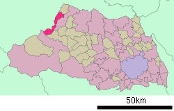 Location of Kamikawa in Saitama Prefecture | ||
 Kamikawa Location in Japan | ||
| Coordinates: 36°13′N 139°6′E / 36.217°N 139.100°ECoordinates: 36°13′N 139°6′E / 36.217°N 139.100°E | ||
| Country | Japan | |
| Region | Kantō | |
| Prefecture | Saitama Prefecture | |
| District | Kodama | |
| Population (2007) | ||
| • Total | 14,912 | |
| Time zone | Japan Standard Time (UTC+9) | |
| Symbols | ||
| - Tree | Sakura | |
| - Flower | Cosmos | |
| - Bird | Japanese Bush-warbler | |
| Website | Town of Kamikawa | |

Kamikawa (神川町 Kamikawa-machi) is a town located in Kodama District, Saitama Prefecture, Japan; situated on the banks of the Kanna River.
As of 2003, the town has an estimated population of 13,704 and a density of 591.45 persons per km². The total area is 23.17 km².
On January 1, 2006 the village of Kamiizumi, from Kodama District, was merged into Kamikawa. The town is served by Tanshō Station (丹荘駅), on the Japan Railway Hachiko Line, which is part of the Greater Tokyo transportation system. Children and young adult education resources include Kamikawa Junior High School (神川中学校), Aoyagi Elementary School (青柳小学校), and Tansho Elementary School (丹荘小学校).
Landmarks
- Kanasana Shrine (金鑚神社)
- Mizube Koen (水辺公園)
- Hasegawa Grocery Store (はせがわスーパー)
External links
![]() Media related to Kamikawa, Saitama at Wikimedia Commons
Media related to Kamikawa, Saitama at Wikimedia Commons
- Kamikawa official website (Japanese)
| |||||||||||||||||||||||||