Kamarang
Coordinates: 5°51′55″N 60°36′51″W / 5.86528°N 60.61417°W
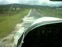
Approach of Kamarang airstrip.Taken from cockpit of Cessna 208 Caravan
Kamarang is an Amerindian and mining village, standing at the confluence of the Kamarang River and Mazaruni River, in the Cuyuni-Mazaruni Region of Guyana. Its altitude is 490 metres (1601 feet).
Kamarang has a Primary School, Hospital, Police station and a paved airstrip. The village has seen extensive economic growth at the start of the 21st century and has remained a hotspot for economic activities which include Gold and Diamond Mining.