Kamalasai District
| Kamalasai กมลาไสย | |
|---|---|
| Amphoe | |
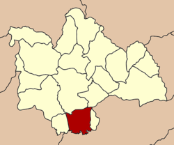 Amphoe location in Kalasin Province | |
| Coordinates: 16°20′20″N 103°34′31″E / 16.33889°N 103.57528°ECoordinates: 16°20′20″N 103°34′31″E / 16.33889°N 103.57528°E | |
| Country |
|
| Province | Kalasin |
| Area | |
| • Total | 325.3 km2 (125.6 sq mi) |
| Population (2005) | |
| • Total | 69,535 |
| • Density | 213.8/km2 (554/sq mi) |
| Time zone | ICT (UTC+7) |
| Postal code | 46130 |
| Geocode | 4603 |
Kamalasai (Thai: กมลาไสย) is a district (amphoe) in the southern part of Kalasin Province, northeastern Thailand.
Geography
Neighboring districts are (from the west clockwise) Khong Chai, Mueang Kalasin, Don Chan of Kalasin Province, Pho Chai of Roi Et Province, Rong Kham of Kalasin Province again, and Changhan of Roi Et Province again.
Administration
The district is subdivided into eight subdistricts (tambon), which are further subdivided into 111 villages (muban). There are three townships (thesaban tambon). Kamalasai covers parts of the tambon Kamalasai and Lak Mueang; Thanya covers parts of tambon Thanya; and Nong Paen the whole of tambon Nong Paen. There are a further seven tambon administrative organizations (TAO).
| No. | Name | Thai name | Villages | Inh. | |
|---|---|---|---|---|---|
| 1. | Kamalasai | กมลาไสย | 18 | 11,105 | |
| 2. | Lak Mueang | หลักเมือง | 14 | 10,048 | |
| 3. | Phon Ngam | โพนงาม | 13 | 7,914 | |
| 4. | Dong Ling | ดงลิง | 17 | 10,443 | |
| 5. | Thanya | ธัญญา | 15 | 9,522 | |
| 8. | Nong Paen | หนองแปน | 9 | 6,885 | |
| 10. | Chao Tha | เจ้าท่า | 16 | 8,329 | |
| 11. | Khok Sombun | โคกสมบูรณ์ | 9 | 5,289 |
Missing numbers are tambon which now form Khong Chai district.