Kamalamai
| Kamalamai कमलामाई नगरपालिका | |
|---|---|
| Municipality | |
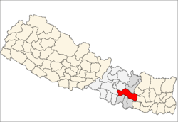
 Kamalamai Location in Nepal | |
| Coordinates: 27°9′0″N 85°54′0″E / 27.15000°N 85.90000°ECoordinates: 27°9′0″N 85°54′0″E / 27.15000°N 85.90000°E | |
| Country |
|
| Zone | Janakpur Zone |
| District | Sindhuli District |
| Government | |
| • Type | Kamalamai Municipality |
| Population (2011[1]) | |
| • Total | 39,413 |
| Time zone | Nepal Time (UTC+5:45) |
| Postal code | 45900 |
| Area code(s) | 047 |
| Website |
www |
Kamalamai (former name: Sindhulimadi; Nepali: सिन्धुलीमाडी) is a municipality in Sindhuli District, in the Janakpur zone of central south Nepal. At the time of the 2011 Nepal census it had a population of 39,413 people in 9,304 households.[2] The city is located in the Sindhuli Valley of central south Nepal. The historic symbol of the valley, Sindhuli Gadhi fort, is at the peak of a hill of the Mahabharata range. The city is in the plain valley made by the Kamla River. Kamalamai Municipality is the largest municipality of Nepal according to area.
History
The occupation of the Kuti Pass in about 1756 stopped the valley's trade with Tibet. Finally, King Prithvi Narayan Shah entered the valley after the victory of Kirtipur. King Jaya Prakash Malla of Kathmandu sought help from the British and so the East India Company sent a contingent of soldiers under Captain Kinloch in 1767. The British force was defeated at Sindhuli by Prithvi Narayan Shah's army. It was the first time a British force was defeated in Asia. The British soldiers were completely taken aback by the geography of the place. They were equipped with modern arms and ammunition like guns and cannons but the Gorkha army was brave and they had a better understanding of the terrain. The place where the army of the British Empire was defeated has widely gained popularity. It is called "Sindhuli Gadhi" and is of great historic significance to Nepal.
Temples
- Kamalamai
- Siddhababa
- Ganesh Than
- Kalimai
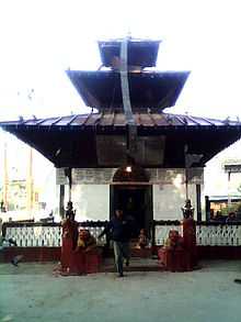 Kalimai Temple
 - Rakta Mala
- Sibalaya
- Gayadevi
Transportation
Regional
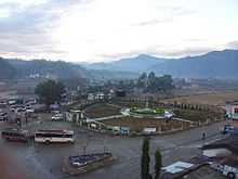
The new section of B.P. Koirala Highway to Kamalamai from Kathmandu opened in 2011 and continues on to Bardibas, though most areas only allow one lane of traffic with hairpin turns. The rest of the route to Bardibas is even and therefore much less dangerous. Also an old road that connects Dharan through Inner Tarai is just going to reopen for the easier movement through the Inner Tarai Valleys of Sindhuli and Udayapur of Western Region to Dharan of Eastern Nepal. Long-route buses run under the local authority in the headquarters which has bus routes to cities like Kathmandu, Janakpur,Biratnagar and Pokhara.
transportation
Local transportation consists of minibuses and minivans which have been regulated by the local people in the headquarters while most of the parts of Kamalamai are inaccessible to vehicles.
Towns
East
- Madhi Bazaar
- Ratamata
- Panityanki
- 2no Bazar
- Gayari Bazar
West
- Dhakal Gaun
- Gayatar
- Milanchock
North
- Dhungrebaas
South
- Madhutar
- Dhurabazaar
Communications
Telecommunication
Lists of telecommunication.
FM
Telecommunication has seen a recent surge thanks to the booming mobile market. The Internet has been introduced recently in the headquarter by private internet providers. To Promote local culture Kamalamai Municipality has three FM radio stations.
- Sindhuligadhi - 92 MHz
- Radio Siddhababa - 98.4 MHz
- Radio Sahara - 104.2 MHz
Internet
Colleges & Schools
Colleges
- Sindhuli Multiple College
- Siddha jyoti Shaya Campus
Schools
- Shree Jana Jyoti Higher Secondary School
- Kamala Higher Secondary School
- Gaumati Higher Secondary School
- Barun devi Higher Secondary School
- Daurali Nimna Secondary School
- Panitanki Higher Secondary School
- Kalimati Nimna Secondary School
- New English Higher Secondary Boarding School
- Siddhababa English Boarding High School
Major Crops
Program
- 2072-01-01 Radio Siddhababa New year Program