Kallara, Thiruvananthapuram
| Kallara | |
|---|---|
| village | |
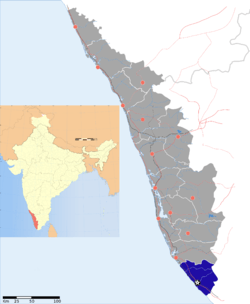
 Kallara Location in Kerala, India | |
| Coordinates: 8°42′46″N 76°57′08″E / 8.712718°N 76.952361°ECoordinates: 8°42′46″N 76°57′08″E / 8.712718°N 76.952361°E | |
| Country |
|
| State | Kerala |
| District | Thiruvananthapuram |
| Talukas | Nedumangad |
| Population (2001) | |
| • Total | 25,779 |
| Languages | |
| • Official | Malayalam, English |
| Time zone | IST (UTC+5:30) |
| PIN | 695608[1] |
| Telephone code | 0472-28 |
| Vehicle registration | KL-01, KL-16 |
| Nearest city | Trivandrum |
| Lok Sabha constituency | Attingal |
| Vidhan Sabha constituency | Vamanapuram |
Kallara is a village and a Grama Panchayat[2] in Thiruvananthapuram district in the state of Kerala, India. It is located near Karette, a junction in the MC road. [3]
Kallara is about 40 km away from Thiruvananthapuram city, 7 km distance from State High Way road and 20 km far from National High Way 47. One of the Famous Temple "Kallara Ayiravilly Kshethram". From kallara-Chervalam road (2 km from kallara) Pattara located one of the famous Anjaneya Temple, Pattara valavil kottayil shree anjaneyaswami temple. From, Kallara -Tholikkuzhy road, one can reach the famous "Mahadevarpacha Siva kshetram" Temple about 1 km from Kallara. Famous "Thachonam Sree Devi Kshethram" is around 2km from Kallara town. (2.5km from kallara) vazhathoppupacha located famous club "JWALA".
Demographics
As of 2001 India census, Kallara had a population of 25,779 with 12,080 males and 13,699 females.[3]
Politics
Assembly constituency: Vamanapuram Lok Sabha constituency: Attingal.
References
- ↑ "India Post :Pincode Search". Retrieved 2008-12-16.
- ↑ Kallara, Grama Panchayat. "Grama Panchayat Information". Government of Kerala. Retrieved 28 January 2014.
- ↑ 3.0 3.1 "Census of India : Villages with population 5000 & above". Retrieved 2008-12-10.
|first1=missing|last1=in Authors list (help)
| |||||||||||||||||||||||||||||||||||||||||||||||||||||||||||
Pincode: 695608