Kaleerwe
| Kaleerwe | |
|---|---|
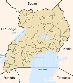
 Kaleerwe Map of Kampala showing the location of Kyebando. | |
| Coordinates: 00°21′36″N 32°34′12″E / 0.36000°N 32.57000°E | |
| Country |
|
| Region | Central Uganda |
| District | Kampala Capital City Authority |
| Division | Kawempe Division |
| Elevation | 11,180 m (36,680 ft) |
| Time zone | EAT (UTC+3) |
Kaleerwe is a neighborhood within Kampala, Uganda's capital and largest city.
Location
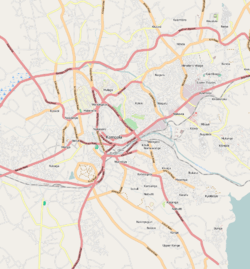
Kaleerwe is bordered by Kawempe to the north, Kyebando to the east, Makerere to the south, Bwaise to the southwest and Kazo to the west. It sandwiched between the Kampala-Masindi Highway to the west, the Kampala-Gayaza Highway to the east, the Kampala Northern Bypass Highway to the south. This location lies approximately 6 kilometres (3.7 mi), by road, north of Kampala's central business district.[1] The coordinates of Kaleerwe are:0°21'07.0"N, 32°34'19.0"E (Latitude:0.351950; Longitude:32.571950).[2]
Overview
Kaleerwe is a busy road-side marketplace, beyond which is a residential slum.[3] Due to its relative low altitude, compared to the surrounding hills, and its proximity to a wetland, the area is prone to flooding.[4] Kaleerwe merges with its immediate slum-neighborhood to the southwest, Bwaise. One may argue that Kaleerwe is part of Bwaise.
Points of interest
- The Kampala Northern Bypass Highway, passes through the neighborhood in a general east to west direction.
- The Kampala-Gayaza Highway passes through the neighborhood in a north to south direction.
- The Kaleerwe Central Market
- The Lubigi wetland has its origins in the streams and drainage channels in Kaleerwe.
- A branch of Equity Bank (Uganda)
- A branch of Finace Trust Bank
- Diamond Impex Supermarket - Located along Kampala-Gayaza Highway.
See also
References
- ↑ "Map Showing Kampala And Kaleerwe With Distance Marker". Globefeed.com. Retrieved 14 June 2014.
- ↑ Google, . "Location of Kaleerwe At Google Maps". Google Maps. Retrieved 14 June 2014.
- ↑ Newvision, Archive (28 January 2007). "Support The Plastic Recycling Company". New Vision. Retrieved 14 June 2014.
- ↑ Birungi, Harriet (17 November 2006). "Is Your House Flood-Protected?". New Vision. Retrieved 14 June 2014.