Kaku, Nepal
| Kanku, Nepal काँकु | |
|---|---|
| Village development committee | |
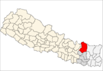
 Kanku, Nepal Location in Nepal | |
| Coordinates: 27°30′N 86°39′E / 27.50°N 86.65°ECoordinates: 27°30′N 86°39′E / 27.50°N 86.65°E | |
| Country | Nepal |
| Zone | Sagarmatha Zone |
| District | Solukhumbu District |
| Population (1991) | |
| • Total | 3,896 |
| Time zone | Nepal Time (UTC+5:45) |
Kaku, Nepal is a village development committee in Solukhumbu District in the Sagarmatha Zone of north-eastern Nepal. At the time of the 1991 Nepal census it had a population of 3896 people living in 750 individual households.[1]
References
- ↑ "Nepal Census 2001". Nepal's Village Development Committees. Digital Himalaya. Retrieved 14 November 2008.