Kafue Flats
- This article is about the river. See Kafue (disambiguation) for other uses.
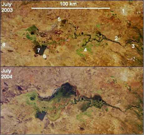
The Kafue Flats are a vast area of swamp, open lagoon and seasonally inundated flood-plain on the Kafue River in the Southern Province of Zambia. They are a shallow flood plain 240 km long and about 50 km wide,[1] flooded to a depth of less than a metre in the rainy season (deeper in some lagoons and permanently swampy areas), and drying out to a clayey black soil in the dry season.

Geography
The Kafue Flats stretch for approximately 240 km east to west along the Kafue River from below the Itezhi-Tezhi gap, site of the Itezhi-Tezhi Dam, to Kafue town and the start of the Kafue Gorge. At their widest point they are 50 km wide and their total area is around 6,500 sq km. The elevation of the Kafue river falls 40 m along the flats from 1030 m at Itezhi-Tezhi to 990 m at Kafue town.
The town of Mazabuka and the Nakambala sugar estate lie on the south east edge and the small town of Namwala is situated at the south west edge of the flats.
Wildlife
The Kafue Flats are a major wildlife area of Zambia and include the Lochinvar and Blue Lagoon National Parks.
The Kafue Lechwe (Kobus leche kafuensis), an antelope specialised for living in the marshy conditions of the flats,[2] is endemic to the area. There were estimated to be 250,000 Lechwe living on the Kafue Flats in 1931, one of the highest animal carrying capacities in the world at 11,000 kg per sq km.[2]
By 2005 the number of Lechwe was estimated to have fallen to 38,000. The declining numbers of Kafue Lechwe has been attributed to the building of the Itezhi-Tezhi Dam and subsequent change in intensity and timing of flooding as well as illegal poaching and the pressures of rising numbers of people and cattle.[3]
The Kafue Flats are also home to a large number of bird species and the area has been designated an Important Bird and Biodiversity Area (IBA) by Birdlife International. The flats are home to the wattled crane (Bugeranus carunculatus) listed in the IUCN Red List as Vulnerable as well as 49 other IBA trigger species.[4]
The Kafue Flats were entered onto the Ramsar list of Wetlands of International Importance in 1991 covering an area of 600,500ha.[6]
References
- ↑ Google Earth accessed 1 March 2007.
- ↑ 2.0 2.1 Schuster, Richard (1980). "Will the Kafue Lechwe Survive the Kafue Dams?". Oryx 15 (5): 476–489. doi:10.1017/s0030605300029203.
- ↑ Chansa, Wilbroad; Kampamba, George (2010). "The population status of the Kafue Lechwe in the Kafue Flats, Zambia". African Journal of Ecology 48 (3).
- ↑ "Important Bird Areas factsheet: Kafue Flats". http://www.birdlife.org''. Birdlife International. Retrieved 23 August 2014.
- ↑ NASA Visible Earth website: “Floodwaters Renew Zambia’s Kafue Wetland” Accessed 5 March 2007.
- ↑ "The Annotated Ramsar List: Zambia". http://www.ramsar.org''. The Ramsar Convention on Wetlands. Retrieved 23 August 2014.