Kaema Plateau
| Kaema Plateau | |
 | |
| Korean name | |
|---|---|
| Chosŏn'gŭl | 개마고원 |
| Hancha | 蓋馬高原 |
| Revised Romanization | Gaema gowon |
| McCune–Reischauer | Kaema kowŏn |
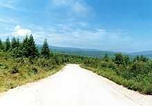
The Kaema Plateau is a highland in North Korea. It is surrounded by Rangrim Mountains, Macheollyeong Mountains and Bujeollyeong Mountains. It varies between 700 and 2,000 meters of altitude and at 40,000 square kilometers, sloping downward towards the northern border with People's Republic of China. It is largest tableland in Korea; it is often called "The roof of Korea". In North Korea, Kaema Plateau is divided into Kaema Plateau, Jagang Plateau, and Baekmu Plateau (in Musan). In this case, the area of Kaema Plateau reaches about 10,000 square kilometers. This Plateau was a flat plain before million years ago, an extension of Manchurian plains. Therefore, rivers like Hochon and Changjin were tributaries of Songhua River. However, the plain have uplifted to elevation of nowadays. Also, basalt from Baekdu Mountain accumulated in Changbai Korean Autonomous County, inducing the rivers into Amnok River. The valleys were formed afterward by the tributaries. Thus, flat terrain still remains in some part in southeastern part of the plateau.
External links
Coordinates: 40°41′58″N 126°59′26″E / 40.699381°N 126.990509°E