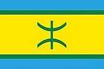
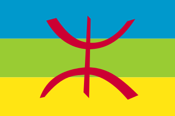
Kabylie
| Kabylia Tamurt n Iqbayliyen (Kabyle) بلاد القبائل (Arabic) La Kabylie (French) | ||
|---|---|---|
| ||
| Coordinates: 37°49′N 4°50′E / 37.817°N 4.833°E | ||
| Country |
| |
| Provinces - Wilayas | Tizi ouzou, Béjaïa, Sétif, Bouïra, Jijel, Boumerdès, Bordj Bou Arréridj | |
| Area | ||
| • Total | 25,000 km2 (10,000 sq mi) | |
| Population (2012) | ||
| • Total | 7,575,643 | |
| • Density | 300/km2 (780/sq mi) | |
| Demonym |
Kabyles Iqbayliyen | |
| ISO 3166-2 | KAB | |
| Area code | +213 (Kabylia) | |
| Languages |
Kabyle Algerian Arabic Literary Arabic | |
Kabylie or Kabylia (Berber: Tamurt n Iqbayeliyen), is a natural and historical region in the north of Algeria.
It is part of the Tell Atlas mountains and is located at the edge of the Mediterranean Sea. Kabylie covers several provinces of Algeria: the whole of Tizi Ouzou and Bejaia (Vgayet), most of Bouira (Tubirett) and parts of the wilayas of Boumerdes, Setif, Bordj Bou Arreridj and Jijel. Gouraya National Park and Djurdjura National Park are also located in Kabylie.
History


Antiquity
Kabylia was a part of the Kingdom of Numidia (202 BC – 46 BC). It was later taken over by the Roman Empire, and became split between the provinces of Africa and Mauretania Caesariensis. In AD 289, the Quinquegentiani, a Berber tribe from Kabylia, rebelled against Roman rule; the rebels were defeated in a year-long Roman offensive in the years 297-298, in which the Quinquegentiani were driven from their homeland in Kabylia, into the Sahara.
Middle Ages
The Kabyle country remained as unconquerable as it was inaccessible to the Ottoman deys. They generally established a few coastal military settlements and some in valleys, where they imposed the rule of the Islamic Ottoman Empire. The mountainous core land, however, remained independent. Islam was gradually adopted through peaceful means, namely the Marabout movement. Some scholars argue that this is the reason of the Kabyles' indifference towards Islam. The Ottoman threat disappeared with the arrival of the European and American navies to conquer North Africa.
Regency of Algiers
During the Regency of Algiers, most of Kabylia was independent. Kabylia was split into two main kingdoms, the Kingdom of Kuku in modern Tizi Ouzou, and the Kingdom of Ait Abbas in modern Béjaïa.
Modern age
.jpg)
Though the region was the last stronghold against French colonization,[1] the area was gradually taken over by the French from 1857, despite vigorous local resistance by the local population led by leaders such as Faḍma n Sumer, continuing as late as Mokrani's rebellion in 1871. Much land was confiscated in this period from the more recalcitrant tribes and given to French pieds-noirs. Many arrests and deportations were carried out by the French in response to uprisings, mainly to New Caledonia. Colonization also resulted in an acceleration of the emigration into other areas of the country and outside of it.
Algerian migrant workers in France organized the first party promoting independence in the 1920s. Messali Hadj, Imache Amar, Si Djilani, and Belkacem Radjef rapidly built a strong following throughout France and Algeria in the 1930s and actively trained militants who became key players during the struggle for independence and in building an independent Algerian state.
During the War of Independence (1954–1962), Kabylie was one of the areas most affected because of the importance of the maquis (aided by the mountainous terrain) and resultant French counter-insurgency operations. Several historic leaders of the FLN came from this region, including Hocine Aït Ahmed, Abane Ramdane, and Krim Belkacem.
After independence
Tensions developed between Kabyle leaders and the central government on several occasions, initially in 1963, when the Socialist Forces Front party of Hocine Aït Ahmed contested the use of the name of a popular resistance movement as a political party, by Nasserian agents, of lower grade within the FLN, who were incapable of organizing their respective regions to provide delegates for the establishment of the first legitimate Algerian constitution. A junta organized as a temporary government with military support from Nasser and other pan-Arabists succeeded in preventing such a convention and a legitimate constitution was enacted by a legitimate parliament. A year of armed confrontation resulted, in which most FLN leaders from Kabylie and the eastern provinces were either executed or pushed into exile. In 1980, several months of demonstrations demanding the officialization of the Tamazight/Berber language, known as the Berber Spring, took place in Kabylie and Algiers, resulting in the extra-judiciary imprisonment of thousands of Kabyle intellectuals. Government security forces violently prevented a conference on old Kabylie poetry by the faculty and students of the main city of Kabylie, Tizi Ouzou.
The politics of identity intensified with the Arabization program by the national government which the Kabyle opposed. The government's emphasis on Islam in what had been a secular society was also resisted, as was its sponsorship of Egyptian clerics as teachers, and the designation of Arabic as the only official language in Algeria. Effectively, Kabyle children were educated in Arabic and/or French and thus spoke but many could not read or write their native tongue - Kabylie. The prevention of a conference on old Kabylie poetry was a political response of the Government to a political initiative by the Kabylie people.
With the tensions of civil war, in 1994–1995, the ten-million-strong population of Kabylie conducted a full-year school boycott, termed the "strike of the school bag". In June and July 1998, the area blazed up again after the assassination of protest singer and political activist Lounès Matoub at the same time that a law requiring the use of the Arabic language in all fields of education went into effect, worsening tensions. In the months following April 2001 (called the Black Spring), major riots — together with the emergence of the Arouch, a confederation of ancestral local councils, as the only authority in the region — followed the killing of Masinissa Guermah, a young Kabyle, by gendarmes.
The Movement for the autonomy of Kabylie (MAK) has called for self-government of the region.
Since 23 March 2007, the Algerian military has conducted extensive searches in the Kabylie region in search of members of the Al-Qaeda Organization in the Islamic Maghreb (QOIM). Two major roads, between Bgayet Béjaïa and Amizour and between El-Kseur and tubiret Bouïra, have been partially closed. The bombings in Algiers on 11 April 2007 rendered this search all the more urgent, as the QOIM has recently become the arm of the al-Qaeda Network in the Maghreb.
Geography

Main features:
- Grande Kabylie which runs from Thénia (west) to Bgayet (Bejaia) (east), and from the Mediterranean Sea (north) to the valley of Soummam (south), that is to say, 200 km by 100 km, beginning 50 km from Algiers, the capital of Algeria.
- Kabylie of Bibans and Kabylie of Babors, which form the Petite Kabylie.
Three large chains of mountains occupy most of the area:
- In the north, the mountain range of maritime Kabylie, culminating with Tifrit n'Ait El Hadj (Tamgout 1278 m)
- In the south, the Djurdjura, dominating the valley of Soummam, culminating with Lalla-Khedidja (2308 m)
- Between the two lies the mountain range of Agawa, which is the most populous and is 800 m high on average. The largest town of Grande Kabylie, Tizi Ouzou, lies in that mountain range. At Iraten (formerly "Fort-National" in French occupation), which numbered 28,000 inhabitants in 2001, is the highest urban centre of the area.
The region's size is similar to that of Denmark.[2]
Ecology
There are a number of flora and fauna associated with this region. Notable is a population of the endangered primate, Barbary Macaque, Macaca sylvanus, whose prehistoric range encompassed a much wider span than the present limited populations in Algeria, Morocco and Gibraltar.[3]
Population
The area is populated by the Kabyle, a Berber ethnic group, the second most populous Berber people after the Chleuh in Morocco. They speak the Kabyle variety of Berber. Since the Berber Spring in 1980, Kabyles have been at the forefront of the fight for recognition of the Berber language as an official one in Algeria (see Languages of Algeria) and for secularism (laïcité) in the country.
Economy
The traditional economy of the area is based on arboriculture (orchards, olive trees) and on the craft industry (tapestry or pottery). The mountain and hill farming is gradually giving way to local industry (textile and agro-alimentary).
Today Kabylie is one of the most industrialised parts of Algeria.[4] Kabylie produces less than 15% of Algerian GDP (excluding oil and gas).[5] Industries include: pharmaceutical industry in Bgayet Bejaia, agro-alimentary in Ifri and Akbou, mechanical industry in Tizi Ouzou and other small towns of western Kabylie, and petrochemical industry and oil refining in Bgayet Bejaia.[5]
Bgayet Bejaia's port is the second biggest in Algeria after Algiers, and the 6th largest on the Mediterranean Sea.
Politics
- Two political "Algerianist" parties have their principal support base in Kabylie: the FFS, led by Hocine Aït Ahmed, and the RCD, led by Saïd Sadi. Both parties are secularist, Berberist and "Algerianist".
- The Aarchs (Kabyle confederations) emerged during the Black Spring of 2001 as a revival of the Kabyle pre-colonial political system. Although the system is indigenous in its form, the Aarchs' political action was meant for all Algerians.
- The MAK (Movement for the autonomy of Kabylie) also emerged during the Black Spring. It is a political movement that militates for self-government in Kabylie.
- On 21 April 2010, Ferhat Mehenni, the then president of the MAK (Movement for the autonomy of Kabylie) proclaimed in Paris a Provisional Government of Kabylie in exile (ANAVAD) which was established officially on 1 June 2010 at the Palais des Congrès. He was elected President by the National Council of the MAK and he named nine Ministers.
Since the Black Spring, Kabyle politics can be divided into two sides: the "Kabyle movement", or Kabyle nationalists, which fight for a large autonomy statut, or independence of Kabylie, and "Algerianists", who are Kabyle political supporters of remaining with the rest of Algeria.
The MAK remains the largest political force in Kabylie .
Black spring
In Kabylie, popular uprising among the Amazighs of Kabyles in 2001. The Black Spring saw numerous small and large demonstrations, in many cases, demonstrators and police or security forces clashed. The number of dead from the actions, have been set to 126, but there figures are uncertain. The demands of the demonstrators were related to Kabyle and Berber identity, a protest against the Arab government of Algiers. Central was the demand for local administration, the withdrawal of the gendarmerie and the call for making Tamazight Berber an official language. These demands were eventually met, but several of lesser importance were not met. Still, the loss of control in the region would have long time effects in terms of stability
See also
- Portal:Berbers
- Portal:Algeria
References
- ↑ "Kabylia - Oxford Islamic Studies Online". Oxfordislamicstudies.com. 2008-05-06. Retrieved 2015-03-06.
- ↑ "Colonised by the Arabs, Abandoned by the World | Inter Press Service". Ipsnews.net. 2012-08-07. Retrieved 2015-03-06.
- ↑ "Barbary Macaque (Macaca sylvanus) - iGoTerra.com". Globaltwitcher.auderis.se. Retrieved 2015-03-06.
- ↑ "Tmurt Iqvayliyen ass-agi", Maxime Ait Kaki
- ↑ 5.0 5.1 "Tadamsa taqbaylit", Saεid Duman
External links
| Wikimedia Commons has media related to Kabylie. |