Kabugao, Apayao
| Kabugao | |
|---|---|
| Municipality | |
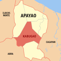 Location in the province of Apayao | |
.svg.png) Kabugao Location within the Philippines | |
| Coordinates: 18°01′N 121°11′E / 18.017°N 121.183°ECoordinates: 18°01′N 121°11′E / 18.017°N 121.183°E | |
| Country | Philippines |
| Region | Cordillera Administrative Region (CAR) |
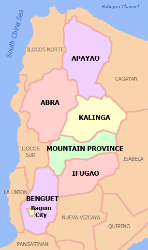
| Province | Apayao |
| District | Lone District |
| Founded | 1950 |
| Barangays | 21 |
| Government[1] | |
| • Mayor | Joseph C. Amid |
| Area[2] | |
| • Total | 935.12 km2 (361.05 sq mi) |
| Population (2010)[3] | |
| • Total | 16,170 |
| • Density | 17/km2 (45/sq mi) |
| Time zone | PST (UTC+8) |
| ZIP code | 3809 |
| Dialing code | 74 |
| Income class | 1st class |
Kabugao is the capital municipality of the province of Apayao in the Philippines. According to the 2010 census, it has a population of 16,170 people.[3]
Barangays
Kabugao is politically subdivided into 21 barangays.[2]
- Badduat
- Baliwanan
- Bulu
- Dagara
- Dibagat
- Cabetayan
- Karagawan
- Kumao
- Laco
- Lenneng
- Lucab
- Luttuacan
- Madatag
- Madduang
- Magabta
- Maragat
- Musimut
- Nagbabalayan
- Poblacion
- Tuyangan
- Waga
Dibagat
Dibagat is inhabited by the Isnag. There is a small grass airstrip built by SIL in 1985. Dibagat is accessible only by canoe or by specialized aircraft.
Demographics
| Population census of Kabugao | ||
|---|---|---|
| Year | Pop. | ±% p.a. |
| 1990 | 11,198 | — |
| 1995 | 12,710 | +2.40% |
| 2000 | 13,985 | +2.07% |
| 2007 | 14,529 | +0.53% |
| 2010 | 16,170 | +3.97% |
| Source: National Statistics Office[3] | ||
Images
-

River which flows through Barangay Dibagat.
-
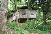
A typical home in Barangay Dibagat.
References
- ↑ "Official City/Municipal 2013 Election Results". Intramuros, Manila, Philippines: Commission on Elections (COMELEC). 11 September 2013. Retrieved 2 January 2014.
- ↑ 2.0 2.1 "Province: APAYAO". PSGC Interactive. Makati City, Philippines: National Statistical Coordination Board. Retrieved 2 January 2014.
- ↑ 3.0 3.1 3.2 "Total Population by Province, City, Municipality and Barangay: as of May 1, 2010". 2010 Census of Population and Housing. National Statistics Office. Retrieved 2 January 2014.
External links
| Wikimedia Commons has media related to Kabugao, Apayao. |
 |
Calanasan | Luna | Pudtol | |
| |
Flora Santo Niño, Cagayan | |||
| ||||
| | ||||
| Tineg, Abra | Conner | Rizal, Cagayan |
| ||||||||||||||
| ||||||||||||||||||||||||||||||||||||