Kabin Buri District
| Kabin กบินทร์บุรี | |
|---|---|
| Amphoe | |
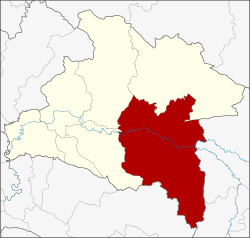 Amphoe location in Prachinburi Province | |
| Coordinates: 13°56′48″N 101°42′48″E / 13.94667°N 101.71333°ECoordinates: 13°56′48″N 101°42′48″E / 13.94667°N 101.71333°E | |
| Country |
|
| Province | Prachinburi |
| Area | |
| • Total | 1,309.28 km2 (505.52 sq mi) |
| Population (2005) | |
| • Total | 134,794 |
| • Density | 103.0/km2 (267/sq mi) |
| Time zone | THA (UTC+7) |
| Postal code | 25110 |
| Geocode | 2502 |
Kabin Buri (Thai: กบินทร์บุรี) is a district (Amphoe) in the southeastern part of Prachinburi Province, eastern Thailand.
History
Mueang Kabin Buri was an ancient city of Ayutthaya kingdom. The city hall located in Ban Hanuman. In 1906 the city hall was moved to Ban Paknam, the area of the Hanuman and Phra Prong Rivers joint together to be Prachin Buri River. On April 1, 1926 the province was abolished and the two districts Mueang Kabin Buri and Aranyapathret became districts of Prachinburi Province.[1]
Geography
Neighboring districts are (from the west clockwise) Si Maha Phot, Prachantakham, Na Di of Prachinburi Province, Mueang Sa Kaeo, Khao Chakan of Sa Kaeo Province and Sanam Chai Khet of Chachoengsao Province.
The important water resource are the Hanuman, Phra Prong and Prachin Buri Rivers.
Climate
| Climate data for Kabin Buri (1981–2010) | |||||||||||||
|---|---|---|---|---|---|---|---|---|---|---|---|---|---|
| Month | Jan | Feb | Mar | Apr | May | Jun | Jul | Aug | Sep | Oct | Nov | Dec | Year |
| Average high °C (°F) | 33.5 (92.3) |
35.2 (95.4) |
36.5 (97.7) |
37.0 (98.6) |
35.0 (95) |
33.5 (92.3) |
32.7 (90.9) |
32.4 (90.3) |
32.5 (90.5) |
32.7 (90.9) |
32.5 (90.5) |
32.0 (89.6) |
33.79 (92.83) |
| Average low °C (°F) | 19.9 (67.8) |
21.9 (71.4) |
23.7 (74.7) |
24.9 (76.8) |
25.0 (77) |
24.8 (76.6) |
24.5 (76.1) |
24.4 (75.9) |
24.3 (75.7) |
23.9 (75) |
22.2 (72) |
19.8 (67.6) |
23.28 (73.88) |
| Average rainfall mm (inches) | 9.0 (0.354) |
24.9 (0.98) |
51.5 (2.028) |
98.8 (3.89) |
192.3 (7.571) |
197.9 (7.791) |
241.2 (9.496) |
290.4 (11.433) |
303.3 (11.941) |
154.5 (6.083) |
29.1 (1.146) |
3.9 (0.154) |
1,596.8 (62.867) |
| Avg. rainy days (≥ 1 mm) | 1 | 2 | 4 | 8 | 17 | 19 | 21 | 22 | 20 | 14 | 5 | 1 | 134 |
| Average relative humidity (%) | 71 | 73 | 72 | 71 | 74 | 75 | 76 | 77 | 80 | 80 | 75 | 70 | 74.5 |
| Source: Thai Meteorological Department (Normal 1981-2010), (Avg. rainy days 1961-1990) | |||||||||||||
Highways
-
 Highway 304 passes through Kabin Buri from Nonthaburi to Korat.
 -
 Highway 33 passes through north side of Kabin Buri from Saraburi to Aranyaprathet.
 - Highway 359 passes through the south side of the Amphoe connecting Highways 304 to Highway 33 and Highway 317.
Administration
The district is subdivided into 14 subdistricts (tambon), which are further subdivided into 192 villages (muban). There are three townships (thesaban tambon) - Kabin covers parts of tambon Kabin, Mueang Kao covers parts of tambon Mueang Kao and Kabin, and Sa Bua parts of tambon Lat Takhian. There are further 14 Tambon administrative organizations (TAO).
| No. | Name | Thai name | Villages | Inh. | |
|---|---|---|---|---|---|
| 1. | Kabin | กบินทร์ | 12 | 14,865 | |
| 2. | Mueang Kao | เมืองเก่า | 22 | 16,704 | |
| 3. | Wang Dan | วังดาล | 16 | 7,154 | |
| 4. | Nonsi | นนทรี | 16 | 7,746 | |
| 5. | Yan Ri | ย่านรี | 12 | 8,229 | |
| 6. | Wang Takhian | วังตะเคียน | 17 | 10,569 | |
| 7. | Hat Nang Kaeo | หาดนางแก้ว | 7 | 4,245 | |
| 8. | Lat Takhian | ลาดตะเคียน | 13 | 10,608 | |
| 9. | Ban Na | บ้านนา | 11 | 8,661 | |
| 10. | Bo Thong | บ่อทอง | 10 | 6,010 | |
| 11. | Nong Ki | หนองกี่ | 12 | 11,574 | |
| 12. | Na Khaem | นาแขม | 11 | 4,524 | |
| 13. | Khao Mai Kaeo | เขาไม้แก้ว | 11 | 8,481 | |
| 14. | Wang Tha Chang | วังท่าช้าง | 22 | 15,424 |
References
- ↑ ประกาศ เรื่อง ยุบจังหวัดกบินทร์บุรีลงเป็นอำเภอขึ้นจังหวัดปราจีน. Royal Gazette (in Thai) 42 (0 ก): 430–431. March 31, 1926.
External links
| ||||||