Kabang District
| Kabang กาบัง | |
|---|---|
| Amphoe | |
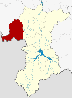 Amphoe location in Yala Province | |
| Coordinates: 6°25′39″N 101°1′9″E / 6.42750°N 101.01917°ECoordinates: 6°25′39″N 101°1′9″E / 6.42750°N 101.01917°E | |
| Country |
|
| Province | Yala |
| Seat | Kabang |
| Area | |
| • Total | 451.0 km2 (174.1 sq mi) |
| Population (2005) | |
| • Total | 17,702 |
| • Density | 39.3/km2 (102/sq mi) |
| Time zone | THA (UTC+7) |
| Postal code | 95120 |
| Geocode | 9507 |
Kabang (Thai: กาบัง) is the westernmost district (Amphoe) of Yala Province, southern Thailand.
History
The name Kabang is actually the Thai corruption of Kabae or Kabe (Jawi: كاب), its original name in Patani Malay language. Kabae or Kabe is a kind of Rambutan tree.
The area of Kabang district was separated from Yaha district to create a minor district (King Amphoe) on April 1, 1991.[1] It was upgraded to a full district on October 11, 1997.[2]
Geography
Neighboring districts are (from the northwest clockwise) Saba Yoi of Songkhla Province, Yaha of Yala province and the state Kedah of Malaysia.
Administration
The district is subdivided into 2 subdistricts (tambon), which are further subdivided into 17 villages (muban). There are no municipal (thesaban) areas within the district, and two Tambon administrative organizations (TAO).
| No. | Name | Thai name | Villages | Inh. | |
|---|---|---|---|---|---|
| 1. | Kabang | กาบัง | 7 | 10,677 | |
| 2. | Bala | บาละ | 10 | 7,025 |
References
- ↑ ประกาศกระทรวงมหาดไทย เรื่อง แบ่งเขตท้องที่อำเภอยะหา จังหวัดยะลา ตั้งเป็นกิ่งอำเภอกาบัง. Royal Gazette (in Thai) 108 (15 ง): 1068. January 31, 1991.
- ↑ พระราชกฤษฎีกาตั้งอำเภอหนองปรือ อำเภอห้วยกระเจา อำเภอทรายทองวัฒนา อำเภอปางศิลาทอง อำเภอเนินสง่า อำเภอนาทม อำเภอพระพรหม อำเภอแม่วงก์ อำเภอสองแคว อำเภอบ้านใหม่ไชยพจน์ อำเภอไทยเจริญ อำเภอกาบัง อำเภอพยุห์ อำเภอเมืองจันทร์ อำเภอภูพาน อำเภอคลองหอยโข่ง อำเภอเขาฉกรรจ์ อำเภอนาวัง อำเภอพิบูลย์รักษ์ และอำเภอทุ่งศรีอุดม พ.ศ. ๒๕๔๐. Royal Gazette (in Thai) 114 (50 ก): 24–27. September 26, 1997.
External links
- amphoe.com (Thai)
| ||||||