K.Pudur Village
| K.Pudur village K.Pudur | |
|---|---|
| Village | |
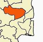
 K.Pudur village Location in K.Pudur village, Perambalur, Tamil Nadu, India | |
| Coordinates: 11°18′43.13″N 78°57′58.32″E / 11.3119806°N 78.9662000°ECoordinates: 11°18′43.13″N 78°57′58.32″E / 11.3119806°N 78.9662000°E | |
| Country |
|
| State | Tamil Nadu |
| District | Perambalur |
| Languages | |
| • Official | Tamil |
| Time zone | IST (UTC+5:30) |
| PIN | 621 115 |
| Telephone code | 04328 |
| Website |
K |
| K.Pudur village | |
K.Pudur village a small village in the district of Perambalur, It is a greenish village in the district of Perambalur There, Tamil Nadu, India.
Geography
K.Pudur Village is located at 11°18′43″N 78°57′58″E / 11.311980°N 78.966200°E, elevation 108 ft. The geographical location of K.Pudur Village.
Economy
Currently, K.Pudur Village is the top Sugarcane, Tapioca, maize and More etc..,
Temples and Festivals
K.Pudur Village has Some temples and places, In this temple the festival is a very most famous festival around this area, similar to the.

- Mariamman temple
- Vinayagar temple
- Sivan temple
- Murugan temple
- Perumal temple
- Selliamman temple
- Karuppusamy temple
Agriculture and Major Crops

Rice and Sugar cane are grown as a major commercial crop. The predominate soil in the district is red sanding with scattered packers of black soil. This village consists mainly of glade soil. The soil in the district is best suited for raising dry crops. Cotton also grown in many places.
- Rice (vast tracts)
- Sugarcane(vast tracts)
- Tapioca(vast tracts)
- Corn
- Cotton (vast tracts)
- Groundnut, Peanut
- Banana, Banana/plantain
- Coconut
- Black Gram
- Millet
External links
 |
Ranjankudi Fort | Namaiyur | Murukkangudi | |
| Valikandapuram | |
Sirumathur Kudikadu | ||
| ||||
| | ||||
| Sirugudal | Keelapuliyur | Elumur |
| |||||||||||||||||||||||||||||||||||||||||||||
| ||||||||||||||||||||||||||||||