Jurong East
| Jurong East | |
|---|---|
| English Name: | Jurong East |
| Chinese Name: | 裕廊东 |
| Hanyupinyin Name: | yùlángdōng |
| Malay Name: | Jurong Timur |
| Tamil Name: | ஜூரோங் கிழக்கு |
| Telugu Name: | జోరాంగ్ ఈస్ట్ |
| Total area: | 3.84 km² |
| Residential area: | 1.65 km² |
| Dwelling units: | 48,477 |
| Projected ultimate: | 22,360 |
| Population: | 29,000 |
Jurong East is a planning area of Singapore. It is bounded by Sungei Pandan, the Pan Island Expressway, Jurong Canal Drive, Boon Lay Way, Yuan Ching Road, the Ayer Rajah Expressway, Jurong Port Road, Jalan Buroh, Jurong Pier Road and the Northern border of Selat Jurong.
History
The development of Jurong started in the 1970s when estates such as Boon Lay, Taman Jurong, Bukit Batok, Bukit Gombak, Hong Kah, Teban Gardens and Yuhua were built, mostly due to the resettlement of Hong Kah (present-day Tengah) and surrounding villages. Yuhua, Teban Gardens, Bukit Batok and Bukit Gombak formed Jurong East.
Sub-zones
There are 10 sub-zones[1] in Jurong East,
- Jurong Port
- Penjuru Crescent
- Jurong River
- Teban Gardens
- Jurong Lake
- Jurong Regional Centre
- International Business Park
- Toh Guan
- Yuhua
- Boon Lay (West of Yuhua)
Housing
Neighborhoods
There are 4 neighborhoods in Jurong East
- N1 - Yuhua (South) and area of Jurong Regional Centre along Jurong Gateway Road.
- N2 - Yuhua (North), Toh Guan and area of Jurong Regional Centre along Boon Lay Way.
- N3 - Boon Lay (Jurong East)
- N4 - Teban Gardens
Politics
The Northern section is under Jurong GRC and Southern section under West Coast GRC.
Education
There are 3 Primary schools and 4 Secondary schools in Jurong East.
- Commonwealth Sec
- Crest Sec
- Fuhua Primary School (which Pandan School merged into)
- Jurong Primary School
- Jurongville Sec
- Shuqun Sec
- Yuhua Primary School
Recreation
Sports
- Jurong East Sports and Recreation Centre
Leisure
- Jurong Lake Park
- Pandan Gardens Park Connector
- Jurong Park Connector
- Toh Guan Neighborhood Park
- Pandan Gardens Leisure Park
- Pandan Reservoir Fitness Corner
- Jurong Country Club
- Hong Kah East Neighborhood Park
- Yuhua Village Neighborhood Park
Tourist Attractions
There are 3 tourist attractions in Jurong East:
Transport
Road
Jurong East is connected to the rest of Singapore with the Pan Island Expressway(PIE) and the Ayer Rajah Expressway(AYE).
- Jurong Town Hall Road interconnects the two expressways with Boon Lay, Yuhua, Jurong Regional Centre, International Business Park, Jurong Lake and Teban Gardens.
- Toh Guan is connected to the PIE via Toh Guan Road, while Jurong Canal Road provides an alternative at Boon Lay for traffic to (Tuas) and from (Changi) the PIE.
- From the AYE, arterial roads Jurong Pier Road, Jurong Port Road and Penjuru Road (along with Minor Arterial road Teban Gardens Crescent) carry the traffic to Jurong River, Penjuru Crescent and Jurong Port.
- Boon Lay Way and Jalan Buroh are the two other arterial roads in Jurong East, which provides inter-connectivity across the various sub-zones in the area.
Public Transport
Mass Rapid Transit
Jurong East is served by 2 MRT stations – Jurong East and Chinese Garden.
Bus
Most of the bus routes in Jurong East originate from Jurong East Bus Interchange, which is adjacent to Jurong East MRT Station.
Economy
At Jurong Port, Jurong River, Penjuru Crescent, and parts of Toh Guan and Teban Gardens, there is land allocated for business activities.
Jurong Lake District
Consisting of Jurong Lake, Jurong Regional Centre, International Business Park and the southern section of Toh Guan, the Jurong Lake District is a prime regional centre serving as an inviting place for commercial development remote from the Central Area, to meet the various demands of business and provide employment opportunities nearer to people staying in the Western region of Singapore.[2]
Commercial
Shopping malls
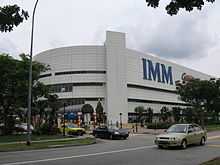
At Jurong Regional Centre and Toh Guan, there are 5 Shopping malls,
| Shopping malls |
|---|

Town Centre
The Town Centre of Jurong East is located at Jurong Regional Centre.
| Jurong East Town Centre |
|---|
 Shophouses at Jurong East, near the Jurong East MRT Station |
External links
References
| Wikimedia Commons has media related to Singapore#Jurong East. |
Coordinates: 1°19′43.98″N 103°44′23.81″E / 1.3288833°N 103.7399472°E
| ||||||||||||||||||||

| ||||||||||||||||||||||