Jurassic Way
| Jurassic Way | |
|---|---|
|
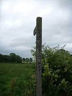
A sign near Welford, Northamptonshire | |
| Length | 88 mi (142 km) |
| Location | Midlands of England, United Kingdom |
| Trailheads |
Banbury, Oxfordshire 52°03′25″N 1°19′48″W / 52.057°N 1.330°W Stamford, Lincolnshire 52°39′02″N 0°28′51″W / 52.6505°N 0.4809°W |
| Use | Hiking |
| Hiking details | |
| Season | All year |
The Jurassic Way is a designated and signed long-distance footpath that connects the Oxfordshire town of Banbury with the Lincolnshire town of Stamford in England.[1] Most of its 88 miles (142 km) route is in Northamptonshire on the Jurassic limestone ridge in the north of that county.[2][3]
The trail goes near to the Oxford and Grand Union Canals, past the Great Central Railway's Catesby Tunnel and viaduct, the River Welland, the 82-arch viaduct at Harringworth,[4] and Rockingham Castle.[5]
It connects with these long-distance footpaths:
- Grand Union Canal Walk,[6]
- Hereward Way,
- Macmillan Ways,[7]
- Midshires Way,
- Oxford Canal Walk.[8]
References
- ↑ jurassicway
- ↑ Ramblers Association - Information - Path - Jurassic Way
- ↑ "County paths". Northamptonshire county council. Retrieved 2013-03-20. ; includes downloadable maps as .pdf
- ↑ Jurassic Way walking route in Northamptonshire
- ↑ Jurassic Way - LDWA Long Distance Paths
- ↑ Grand Union Canal Walk - Paths Routes and Trails - Information - Ramblers' Association
- ↑ Macmillan Way
- ↑ Oxford Canal Walk - Paths Routes and Trails - Information - Ramblers' Association
- "Long distance routes". Rutland county council. Retrieved 2013-03-20.
External links
- Brief details from the Ramblers Association
- Brief details from East Midlands Tourism
- Further details
- Brief details from Northamptonshire County Council
- Walking on the Web page for The Jurassic Way
- The Jurassic Way at geograph.org.uk
- Catesby Tunnel & Viaduct at The Warwickshire Railways site
Coordinates: 52°25′26″N 1°02′35″W / 52.424°N 1.043°W